Датотека:Earth Western Hemisphere.jpg
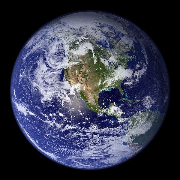
Veličina ovog prikaza: 600 × 600 piksela. 5 drugih rezolucija: 240 × 240 piksela | 480 × 480 piksela | 768 × 768 piksela | 1.024 × 1.024 piksela | 2.048 × 2.048 piksela.
Originalna datoteka (2.048 × 2.048 piksela, veličina datoteke: 579 kB, MIME tip: image/jpeg)
Istorija datoteke
Kliknite na datum/vreme da biste videli tadašnju verziju datoteke.
| Datum/vreme | Minijatura | Dimenzije | Korisnik | Komentar | |
|---|---|---|---|---|---|
| trenutna | 05:09, 25. avgust 2005. | 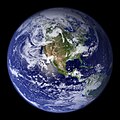 | 2.048 × 2.048 (579 kB) | Tom | {{PD-USGov-NASA}} http://earthobservatory.nasa.gov/Newsroom/BlueMarble/Images/globe_west_2048.jpg Much of the information contained in this image came from a single remote-sensing device-NASA’s Moderate Resolution Imaging Spectroradiometer, or MODIS. |
Upotreba datoteke
63 sledeće stranice koriste ovu datoteku:
- Корисник:A. M. Pejanović
- Корисник:AcoCar
- Корисник:Alek Savic
- Корисник:AlexJ05
- Корисник:Blabladance
- Корисник:Bleki19
- Корисник:Bubbah63
- Корисник:ChaosCrash13
- Корисник:DJKingN
- Корисник:DOHC16V
- Корисник:Dark Lord 1357
- Корисник:Diddlina
- Корисник:Djomla88
- Корисник:Dreadknight
- Корисник:Dungodung
- Корисник:Gudi129
- Корисник:ImperatorkA
- Корисник:IvanaMadzarevic
- Корисник:Jeremić Vlada
- Корисник:Jovana1986
- Корисник:Kadzo
- Корисник:Ljuboni
- Корисник:Ljuboni/О мени
- Корисник:Loshmi
- Корисник:MatkeBG
- Корисник:Millennium175
- Корисник:Mirno
- Корисник:Mmilosavljevic
- Корисник:MzP
- Корисник:Nikola K.
- Корисник:NinaMilosevic
- Корисник:Nova korisnica
- Корисник:Obsuser
- Корисник:OgnjenMaster
- Корисник:Pantic Marko
- Корисник:PenroseT
- Корисник:Petarpeca
- Корисник:Quetzalcoatl
- Корисник:Rastko Pocesta
- Корисник:Ravnicar
- Корисник:Rebelmouse
- Корисник:RedRastko
- Корисник:Sconosciuto~srwiki
- Корисник:SimondR
- Корисник:Skinjara
- Корисник:Smiroje
- Корисник:Stebunik
- Корисник:Stevansan
- Корисник:Tam993
- Корисник:Uros003
- Корисник:Vrabac Podunavac
- Корисник:Vukašin/O мени
- Корисник:Zovemse
- Корисник:Андрејевић
- Корисник:Бојанић Тибор
- Корисник:Бојанић Тибор/Корисничке кутије
- Корисник:Вики555
- Корисник:Вики555/кутијице
- Корисник:Костић Андреја
- Википедија:Шаблони/Кориснички простор/Корисничка кутија/Место боравка
- Википедија:Шаблони/Кориснички простор/Корисничка кутија/Националност
- Шаблон:Корисник Вики/Земља
- Шаблон:Корисник Вики/Космополита
Globalna upotreba datoteke
Drugi vikiji koji koriste ovu datoteku:
- Upotreba na af.wikipedia.org
- Upotreba na ang.wikipedia.org
- Upotreba na ar.wikipedia.org
- العالم
- الأرض
- آسيا
- قارة
- المحيط الهندي
- المحيط الهادئ
- القارة القطبية الجنوبية
- أمريكا الشمالية
- أمريكا الجنوبية
- علم البيئة
- نظام بيئي
- المحيط المتجمد الشمالي
- علوم الأرض
- المحيط المتجمد الجنوبي
- الصفائح التكتونية
- طبيعة
- محيط (جغرافيا)
- تاريخ الأرض
- حيوم
- أستراليا (قارة)
- تغير أسماء دول آسيا خلال القرن العشرين
- برية
- إفريقيا
- المحيط الأطلسي
- بوابة:المجموعة الشمسية
- تاريخ الأرض الجيولوجي
- العالم من دوننا (كتاب)
- بنية الأرض
- قالب:الأرض الطبيعية
- مستقبل الأرض
- اختلال بيئي
- أرض صلبة
- مركز مراقبة علوم وموارد الأرض
- بوابة:المجموعة الشمسية/قوالب
- تاريخ آسيا الوسطى
- بيئة طبيعية
- مستخدم:Nehaoua/مهامي
- دائرة قطبية
- تضاريس قارة إفريقيا
- الفريق المعني برصد الأرض
- بوابة:محيطات
- بوابة:محيطات/قوالب
- Upotreba na arz.wikipedia.org
- Upotreba na ast.wikipedia.org
- Upotreba na bg.wikipedia.org
Još globalnog korišćenja ove datoteke.


