
Датотека:Salt-River-Bay-2.jpg
Величина овог приказа: 800 × 457 пиксела. 4 друге резолуције: 320 × 183 пиксела | 640 × 366 пиксела | 1.024 × 585 пиксела | 1.400 × 800 пиксела.
Оригинална датотека (1.400 × 800 пиксела, величина датотеке: 302 kB, MIME тип: image/jpeg)
| Ово је датотека са Викимедијине оставе. Информације са њене странице са описом приказане су испод. Викимедијина остава је складиште слободно лиценциралних мултимедијалних датотека. И Ви можете да помогнете. |
Опис измене
| Опис |
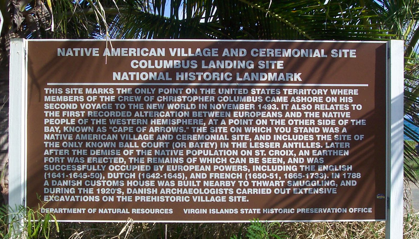
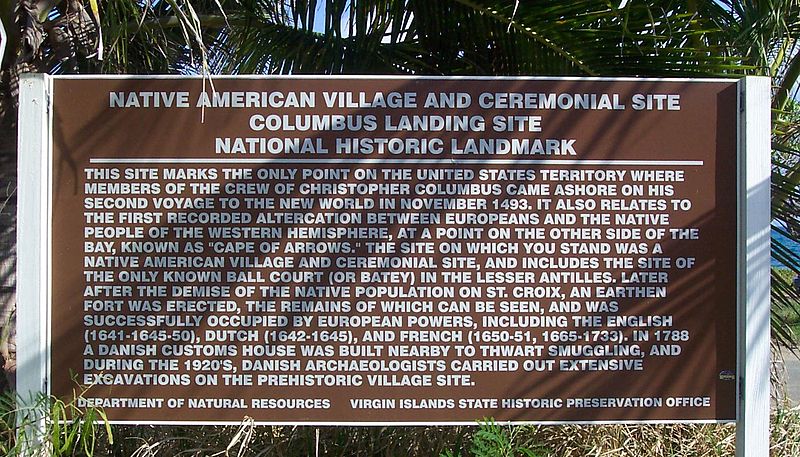
Historical marker/information sign at Salt River Bay National Historical Park and Ecological Preserve. 17°46′44″N 64°45′33″W / 17.77889°N 64.75917°W Transcription:
|
| Датум | |
| Извор | Сопствено дело |
| Аутор | self |
| Дозвола (Поновно коришћење ове датотеке) |
public domain |
Лиценцирање
| Ја, творац овог дела, предајем га у јавно власништво. Ово се односи на цео свет. У неким земљама, ово није законски могуће; у том случају: Ја, творац овог дела дозвољавам свакоме да користи ово дело за било коју намену, без било каквих услова, осим услова које намеће закон. |
Историја датотеке
Кликните на датум/време да бисте видели тадашњу верзију датотеке.
| Датум/време | Минијатура | Димензије | Корисник | Коментар | |
|---|---|---|---|---|---|
| тренутна | 20:26, 7. март 2007. | | 1.400 × 800 (302 kB) | Eoghanacht | {{Information |Description= Historical marker/information sign at {{w|Salt River Bay National Historical Park and Ecological Preserve}}. {{coor dms|17|46|44|N|64|45|33|W|}} |Source= own work |Date= 2007 February |Author= self |Permission= public domain | |
Употреба датотеке
Следећа страница користи ову датотеку:
Глобална употреба датотеке
Други викији који користе ову датотеку:
- Употреба на en.wikipedia.org
- Употреба на it.wikipedia.org
- Употреба на vi.wikipedia.org