
Датотека:Belgrád - 38-45.jpg

Величина овог приказа: 435 × 600 пиксела. 6 других резолуција: 174 × 240 пиксела | 348 × 480 пиксела | 557 × 768 пиксела | 742 × 1.024 пиксела | 1.485 × 2.048 пиксела | 3.591 × 4.952 пиксела.
Оригинална датотека (3.591 × 4.952 пиксела, величина датотеке: 4,36 MB, MIME тип: image/jpeg)
| Ово је датотека са Викимедијине оставе. Информације са њене странице са описом приказане су испод. Викимедијина остава је складиште слободно лиценциралних мултимедијалних датотека. И Ви можете да помогнете. |
|
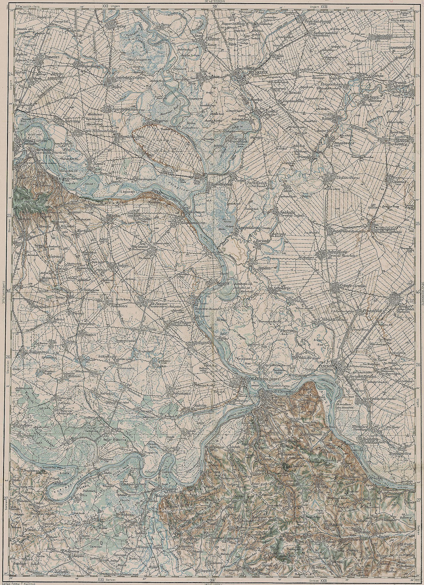
Deutsch: Blatt 38-45 der Generalkarte von Mitteleuropa 1:200.000 der Franzisco-Josephinischen Landesaufnahme, Österreich-Ungarn, ab 1887. Die Blattmitte liegt bei 45° n.Br. und 38° ö.L. (östlich von Ferro, nicht Greenwich!). English: Sheet 38-45 of the General Map of Central Europe, scale 1:200,000, edited 1887 ff. See 3rd Military Mapping Survey of Austria-Hungary for details. The center of the sheet is 45° North, 38° East (east of Ferro, not Greenwich!).
← Nachbarblätter. Klicken Sie auf eine Miniatur, um zu diesem Blatt zu gelangen.
← Neighbouring sheets. Click thumbnail to navigate |


.jpg)
Опис измене
| Опис | 3rd Military Mapping Survey of Austria-Hungary - Belgrád |
| Датум | circa 1910 |
| Извор | http://lazarus.elte.hu/hun/moterkep.htm - László ZENTAI |
| Аутор | Military mapping authority of Austria-Hungary |
| Остале верзије |
.jpg)
Лиценцирање
|
Овај рад је такође у јавном власништву у државама са роком ауторства за живота аутора плус 100 година или мање. Овај рад је у јавном власништву у Сједињеним Државама зато што је објављен или регистрован у канцеларији за ауторска права САД-а пре 1. јануара 1929. | |
| Утврђено је да ова датотека није ограничена у погледу ауторских права, укључујући и сва сродна и суседна права. | |
Историја датотеке
Кликните на датум/време да бисте видели тадашњу верзију датотеке.
| Датум/време | Минијатура | Димензије | Корисник | Коментар | |
|---|---|---|---|---|---|
| тренутна | 09:32, 21. март 2007. | | 3.591 × 4.952 (4,36 MB) | Szilas | == Összefoglaló == 3rd Military Mapping Survey of Austria-Hungary - Belgrád Source: http://lazarus.elte.hu/hun/moterkep.htm - László ZENTAI Category:3rd Military Mapping Survey of Austria-Hungary == Licensing == {{PD-old}} |
Употреба датотеке
Следећа страница користи ову датотеку:
Глобална употреба датотеке
Други викији који користе ову датотеку:
- Употреба на de.wikipedia.org
- Употреба на en.wikipedia.org
- Употреба на fr.wikipedia.org
- Употреба на hu.wikipedia.org
- Употреба на hu.wikibooks.org