
Датотека:India Jammu and Kashmir locator map.svg

Оригинална датотека (SVG датотека, номинално 1.574 × 1.738 пиксела, величина: 966 kB)
| Ово је датотека са Викимедијине оставе. Информације са њене странице са описом приказане су испод. Викимедијина остава је складиште слободно лиценциралних мултимедијалних датотека. И Ви можете да помогнете. |
| Наслов |
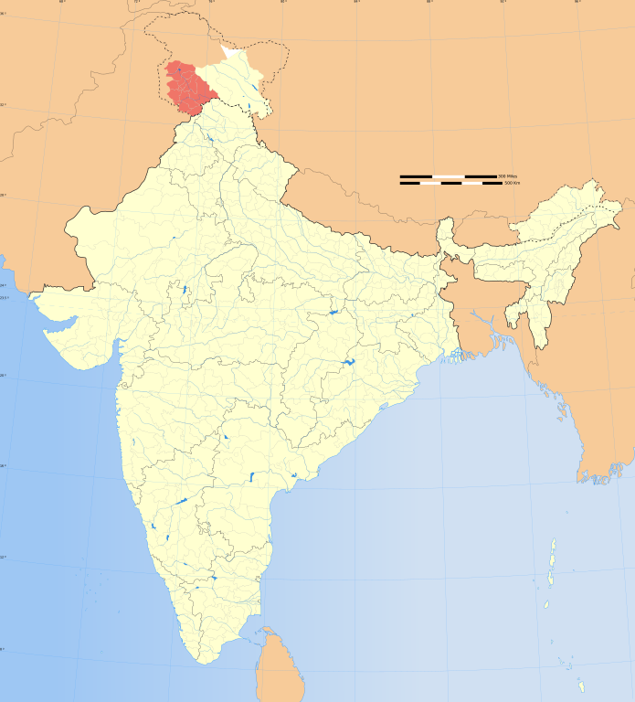
Jammu and Kashmir locator map |
|||||||||
| Опис |
Locator map of the state of Jammu and Kashmir, India with district boundaries. |
|||||||||
| Map legend |
 |
|||||||||
| Датум | ||||||||||
| Извор |
Сопствено дело |
|||||||||
| Творац |
|
|||||||||
| Дозвола (Поновно коришћење ове датотеке) |
Ја, носилац ауторског права над овим делом, објављујем исто под следећом лиценцом: Ова датотека је доступна под лиценцом Creative Commons Ауторство-Делити под истим условима 3.0 Unported.
|
|||||||||
| Geotemporal data | ||||||||||
| Приказ се дешава у времену | second half of 20 century и 21 century | |||||||||
| Просторни референтни сисем | conic | |||||||||
| Bounding box |
|
|||||||||
| Georeferencing | If inappropriate please set warp_status = skip to hide. | |||||||||
| Archival data | ||||||||||
| Белешке | Part of WikiProject India Maps | |||||||||
| Остале верзије |
|
|||||||||


| Open this image as an overlay in Google Earth (Google Maps, Bing) | (Help|Source) |
Notes
Depiction of India's borders
- The territorial boundaries of India are shown as per the actual ground situation in accordance with international practices followed by the United Nations ([1], [2]) and the National Geographic Society ([3], [4])
- This map is meant to be for illustrative purpose only and is not authenticated by official government sources. Please check the list of sources and references used to create the map for a measure of accuracy and verifiability.
- The usage of these maps in India, Pakistan and China are governed by different laws that restrict depictions of boundaries other than what is officially recognized by the state. Please check local laws and modify the map accordingly before use.
Explanation of disputed boundaries


- Boundary of Indian claim : The territory India claims is legally theirs, but the claim is disputed by China and Pakistan.
- Line of Control/Line of Conflict : The de facto administrative boundary recognised by the international community. This UN ceasefire line is considered as a temporary solution to an ongoing conflict since the departure of the British Raj.
Borders of disputed regions
The depicted extent of the former territory of the British Indian Empire, succeeded by Republic of India, may not be accepted by few countries as legal due to ongoing border disputes:
- The northern Himalayan region of the disputed territory Indian-administered Kashmir is claimed by India including (Pakistan-administered Kashmir) and the Chinese-occupied territory of (Ladakh plateau). Since 1972, it is divided between all three countries. See also Line of Control and Line of Actual Control.
- Siachen glacier (shown white) is an actively contested region between India and Pakistan. Since 1984, the region is under Indian control.
- The northeastern territory of Arunachal Pradesh is almost entirely claimed by China as part of its Tibetan territory.
- Minor areas of eastern Kashmir's Ladakh division, Himachal Pradesh and Uttarakhand on the Chinese frontier are claimed by China. These areas are under Indian control.
- A small area of Uttarakhand adjoining the Nepal border along the Sarda river is disputed between the two countries.
For a detailed map of all disputed regions in South Asia, see Image:India disputed areas map.svg
Internal borders
The borders of the state of Meghalaya, Assam and Arunachal Pradesh are shown as interpreted from the North-Eastern Areas (Reorganisation) Act, 1971, but has yet to be verified.
Territorial waters
The limit of the territorial waters of India extends to twelve nautical miles measured from the appropriate baseline. See this for more information.
Историја датотеке
Кликните на датум/време да бисте видели тадашњу верзију датотеке.
| Датум/време | Минијатура | Димензије | Корисник | Коментар | |
|---|---|---|---|---|---|
| тренутна | 15:51, 21. октобар 2020. | | 1.574 × 1.738 (966 kB) | Sbb1413 | Updated. |
| 08:48, 29. децембар 2008. |  | 1.574 × 1.738 (836 kB) | Planemad | {{Information |Description= |Source= |Date= |Author= |Permission= |other_versions= }} | |
| 20:10, 6. август 2006. |  | 1.639 × 1.852 (751 kB) | Planemad | {{WikiProject_India_Maps |Title=Jammu and Kashmir locator map |Description=Locator map of the state of Jammu and Kashmir, India with district boundaries. |Source=. |Date=August 6 2006 |Author=w:user:Nichalpw:user:Planemad |Thumbdir=CH |
Употреба датотеке
Нема страница које користе ову датотеку.
Глобална употреба датотеке
Други викији који користе ову датотеку:
- Употреба на ba.wikipedia.org
- Употреба на bpy.wikipedia.org
- Употреба на de.wikipedia.org
- Употреба на en.wikipedia.org
- Wikipedia:WikiProject India
- Wikipedia:WikiProject Jammu and Kashmir
- Category:Wikipedians in Jammu and Kashmir
- Template:User interest India
- Template:User interest India/doc
- Template:User WP India
- Template:User WP India/doc
- Wikipedia:Userboxes/Location/India
- Template:User in India
- Template:User in India/doc
- Template:User in Jammu and Kashmir
- Template:User in Jammu and Kashmir/doc
- Template:User WP Jammu and Kashmir
- Template:User WP Jammu and Kashmir/doc
- Template:User interest Jammu and Kashmir
- Template:User interest Jammu and Kashmir/doc
- Template:User citizen India
- Template:User citizen India/doc
- Template:User citizen Jammu and Kashmir
- Template:User citizen Jammu and Kashmir/doc
- Template:User from India
- Template:User from India/doc
- Template:User from Jammu and Kashmir
- Template:User from Jammu and Kashmir/doc
- Category:Wikipedians interested in Jammu and Kashmir
- Category:WikiProject Jammu and Kashmir participants
- User:Abdars
- Template:User India/doc1
- Template:User Jammu and Kashmir/doc1
- User:Ambar wiki
- User:فرح دیسائی
- User:Dawa1989
- Template:Portal/doc/all
- User:Mhveinvp
- User:Mubashir Saleem
- User:Owais Khursheed
- User:Aatuif
- User:Debjyoti Gorai
- Wikipedia:Userboxes/Life/Ethnicity/02
- User:Jaywardhan009
- User:Tariq al sama
- Outline of Jammu and Kashmir
- User:AnM2002
- Template:User proud Indian
- Template:User proud Indian/doc
Још глобалног коришћења ове датотеке.