
Датотека:Mid-atlantic ridge map.png
Већа резолуција није доступна.
Mid-atlantic_ridge_map.png (200 × 415 пиксела, величина датотеке: 21 kB, MIME тип: image/png)
| Ово је датотека са Викимедијине оставе. Информације са њене странице са описом приказане су испод. Викимедијина остава је складиште слободно лиценциралних мултимедијалних датотека. И Ви можете да помогнете. |
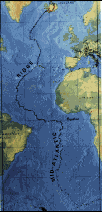
| Опис | small image showing the location of the Mid-Atlantic ridge |
| Извор | [1] |
| Аутор | originally uploaded on the English wikipedia: 14:51, 21 October 2003 . . JamesDay (Talk / contribs) . . 200×415 (21,177 bytes) (mid-Atlantic ridge map) |
| Дозвола (Поновно коришћење ове датотеке) |
Copyright: public domain. US Geological Survey image. Copyright statement: [2] "Information presented on this website is considered public information and may be distributed or copied. Use of appropriate byline/photo/image credit is requested." |
This image is in the public domain in the United States because it only contains materials that originally came from the United States Geological Survey, an agency of the United States Department of the Interior. For more information, see the official USGS copyright policy.
|
Историја датотеке
Кликните на датум/време да бисте видели тадашњу верзију датотеке.
| Датум/време | Минијатура | Димензије | Корисник | Коментар | |
|---|---|---|---|---|---|
| тренутна | 13:02, 1. фебруар 2007. | | 200 × 415 (21 kB) | Woudloper | {{Information |Description=small image showing the location of the Mid-Atlantic ridge |Source=[http://pubs.usgs.gov/publications/text/ridge.html] |Date= |Author=originally uploaded on the English wikipedia: 14:51, 21 October 2003 . . JamesDay (Talk | cont |
Употреба датотеке
Следећа страница користи ову датотеку:
Глобална употреба датотеке
Други викији који користе ову датотеку:
- Употреба на ar.wikipedia.org
- Употреба на ast.wikipedia.org
- Употреба на bg.wikipedia.org
- Употреба на ce.wikipedia.org
- Употреба на da.wikipedia.org
- Употреба на en.wikipedia.org
- Употреба на en.wikibooks.org
- Употреба на es.wikipedia.org
- Употреба на fa.wikipedia.org
- Употреба на fi.wikipedia.org
- Употреба на gl.wikipedia.org
- Употреба на hu.wikipedia.org
- Употреба на is.wikipedia.org
- Употреба на ka.wikipedia.org
- Употреба на ko.wikipedia.org
- Употреба на lt.wikipedia.org
- Употреба на mk.wikipedia.org
- Употреба на ml.wikipedia.org
- Употреба на ms.wikipedia.org
- Употреба на nl.wikipedia.org
- Употреба на no.wikipedia.org
- Употреба на pt.wikipedia.org
- Употреба на ro.wikipedia.org
- Употреба на ru.wikinews.org
- Употреба на simple.wikipedia.org
- Употреба на sl.wikipedia.org
- Употреба на sw.wikipedia.org
- Употреба на tr.wikipedia.org
- Употреба на uk.wikipedia.org
- Употреба на vi.wikipedia.org
- Употреба на zh-yue.wikipedia.org
- Употреба на zh.wikipedia.org