
Датотека:Amityville-ny-map.png
Veća rezolucija nije dostupna.
Amityville-ny-map.png (575 × 425 piksela, veličina datoteke: 72 kB, MIME tip: image/png)
| Ovo je datoteka sa Vikimedijine ostave. Informacije sa njene stranice sa opisom prikazane su ispod. Vikimedijina ostava je skladište slobodno licenciralnih multimedijalnih datoteka. I Vi možete da pomognete. |
Opis izmene
| Opis | |
| Datum | |
| Izvor | http://factfinder.census.gov |
| Autor | United States Census Bureau |
| Dozvola (Ponovno korišćenje ove datoteke) |
Original text : Public domain. |
Licenciranje
This image or file is a work of a United States Census Bureau employee, taken or made as part of that person's official duties. As a work of the U.S. federal government, the image is in the public domain.
|
 |
Prvobitan dnevnik otpremanja
The original description page was here. All following user names refer to en.wikipedia.
- 2007-11-06 12:38 Americasroof 575×425× (71999 bytes) [[Amityville, New York]] map from U.S. Census
Prvobitan dnevnik otpremanja
| Datum/vreme | Dimenzije | Korisnik | Komentar |
|---|---|---|---|
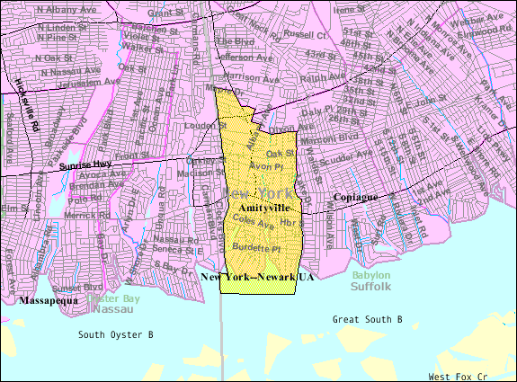
| 19. jun 2013., 17:36:37 | 575 × 425 (71999 bytes) | DanTD (razgovor · doprinosi) | {{Information |Description={{en|[[:en:U.S. Census 2000|]] reference map for [[:en:Amityville, New York|]]<br/> [[:en:Category:US Census Bureau maps of New York State|]] [[:en:Category:Maps of Long Island, New York|]]}} |Source=Transferred from [http:... |
Istorija datoteke
Kliknite na datum/vreme da biste videli tadašnju verziju datoteke.
| Datum/vreme | Minijatura | Dimenzije | Korisnik | Komentar | |
|---|---|---|---|---|---|
| trenutna | 22:01, 14. avgust 2014. | | 575 × 425 (72 kB) | GifTagger | Bot: Converting file to superior PNG file. (Source: Amityville-ny-map.gif). This GIF was problematic due to non-greyscale color table. |
Upotreba datoteke
Sledeća stranica koristi ovu datoteku:
Globalna upotreba datoteke
Drugi vikiji koji koriste ovu datoteku:
- Upotreba na ar.wikipedia.org
- Upotreba na azb.wikipedia.org
- Upotreba na ca.wikipedia.org
- Upotreba na ceb.wikipedia.org
- Upotreba na cy.wikipedia.org
- Upotreba na en.wikipedia.org
- Upotreba na es.wikipedia.org
- Upotreba na eu.wikipedia.org
- Upotreba na fa.wikipedia.org
- Upotreba na fi.wikipedia.org
- Upotreba na ht.wikipedia.org
- Upotreba na sh.wikipedia.org
- Upotreba na sv.wikipedia.org
- Upotreba na www.wikidata.org