
Датотека:Lake Pontchartrain Causeway south.jpg
Veličina ovog prikaza: 800 × 534 piksela. 4 druge rezolucije: 320 × 214 piksela | 640 × 427 piksela | 1.024 × 683 piksela | 1.500 × 1.001 piksela.
Originalna datoteka (1.500 × 1.001 piksela, veličina datoteke: 281 kB, MIME tip: image/jpeg)
| Ovo je datoteka sa Vikimedijine ostave. Informacije sa njene stranice sa opisom prikazane su ispod. Vikimedijina ostava je skladište slobodno licenciralnih multimedijalnih datoteka. I Vi možete da pomognete. |
| Opis |
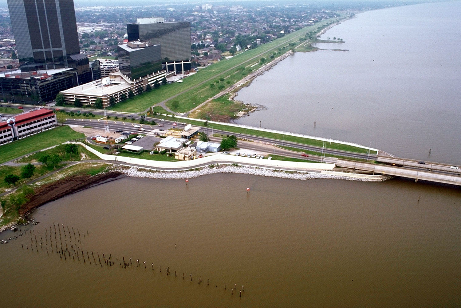
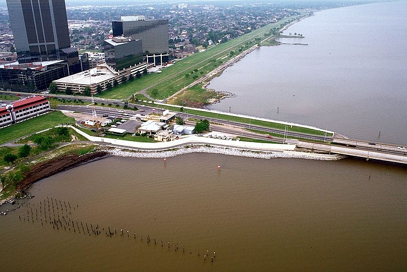
English: The southern end of the Lake Pontchartrain Causeway at Metairie, Louisiana, USA. View is to the southwest near Causeway Boulevard, Metairie. |
|||
| Datum | ||||
| Izvor |
U.S. Army Corps of Engineers Digital Visual Library Image page Image description page Digital Visual Library home page |
|||
| Autor | Arthur Belala, U.S. Army Corps of Engineers | |||
| Dozvola (Ponovno korišćenje ove datoteke) |
|
|||
| Lokacija | New Orleans, Louisiana, USA |
| Положај камере | | Ова и друге слике снимљене у близини на: OpenStreetMap |
|---|
Istorija datoteke
Kliknite na datum/vreme da biste videli tadašnju verziju datoteke.
| Datum/vreme | Minijatura | Dimenzije | Korisnik | Komentar | |
|---|---|---|---|---|---|
| trenutna | 18:59, 1. april 2007. | | 1.500 × 1.001 (281 kB) | DanMS | {{Information | Description = {{en|The southern end of the Lake Pontchartrain Causeway at New Orleans, Louisiana, USA. View is to the southwest over New Orleans.}} | Source = U.S. Army Corps of Engineers Digital Visual Library<br />[http://imag |
Upotreba datoteke
Sledeća stranica koristi ovu datoteku:
Globalna upotreba datoteke
Drugi vikiji koji koriste ovu datoteku:
- Upotreba na ar.wikipedia.org
- Upotreba na cs.wikipedia.org
- Upotreba na el.wikipedia.org
- Upotreba na en.wikipedia.org
- Upotreba na es.wikipedia.org
- Upotreba na fa.wikipedia.org
- Upotreba na fi.wikipedia.org
- Upotreba na fr.wikipedia.org
- Upotreba na id.wikipedia.org
- Upotreba na it.wikipedia.org
- Upotreba na nl.wikipedia.org
- Upotreba na pl.wikipedia.org
- Upotreba na pt.wikipedia.org
- Upotreba na sk.wikipedia.org
- Upotreba na sw.wikipedia.org
- Upotreba na tr.wikipedia.org
- Upotreba na uk.wikipedia.org
- Upotreba na uz.wikipedia.org
- Upotreba na vi.wikipedia.org
- Upotreba na zh-yue.wikipedia.org