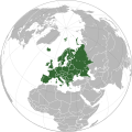
Датотека:Europe orthographic Caucasus Urals boundary (with UN borders).svg

Садржај странице није подржан на другим језицима
Ово је датотека са Викимедијине оставе
С Википедије, слободне енциклопедије

Оригинална датотека(SVG датотека, номинално 537 × 536 пиксела, величина: 406 kB)

Опис измене

Опис
English: Europe orthographic Caucasus Urals boundary (with borders)
Датум
Извор Derived from Europe orthographic Caucasus Urals boundary.svg and Europe on the globe (red).svg.
Аутор Rob984
Остале верзије
SVG genesis
InfoField
W3C red 
The source code of this SVG is invalid due to 148 errors.
Inkscape-no 
This W3C-invalid world map was created with Inkscape…important.
W3CiThe source code of this SVG is valid.
Inkscape-yes 
This vector image was created with Inkscape .

Лиценцирање

Public domain This map is ineligible for copyright and therefore in the public domain, because it consists entirely of information that is common property and contains no original authorship. For more information, see Commons:Threshold of originality § Maps.

English | Español | Galego | Română | slovenščina | العربية | 简体中文 | 繁體中文 | +/−

Натписи

Укратко шта ова датотека представља/приказује
Europe orthographic Caucasus Urals boundary (with UN borders)

Ставке приказане у овој датотеци

приказује

14. јун 2015

image/svg+xml

Историја датотеке

Кликните на датум/време да бисте видели тадашњу верзију датотеке.

Датум/времеМинијатураДимензијеКорисникКоментар
тренутна11:24, 1. мај 2024.Минијатура за верзију на дан 11:24, 1. мај 2024.537 × 536 (406 kB)ЂидоUploaded own work with UploadWizard

Следећа страница користи ову датотеку:

Метаподаци