
Датотека:Trinity crater.jpg
Величина овог приказа: 754 × 599 пиксела. 6 других резолуција: 302 × 240 пиксела | 604 × 480 пиксела | 966 × 768 пиксела | 1.280 × 1.017 пиксела | 2.560 × 2.035 пиксела | 7.880 × 6.263 пиксела.
Оригинална датотека (7.880 × 6.263 пиксела, величина датотеке: 6,33 MB, MIME тип: image/jpeg)
| Ово је датотека са Викимедијине оставе. Информације са њене странице са описом приказане су испод. Викимедијина остава је складиште слободно лиценциралних мултимедијалних датотека. И Ви можете да помогнете. |
| Опис |
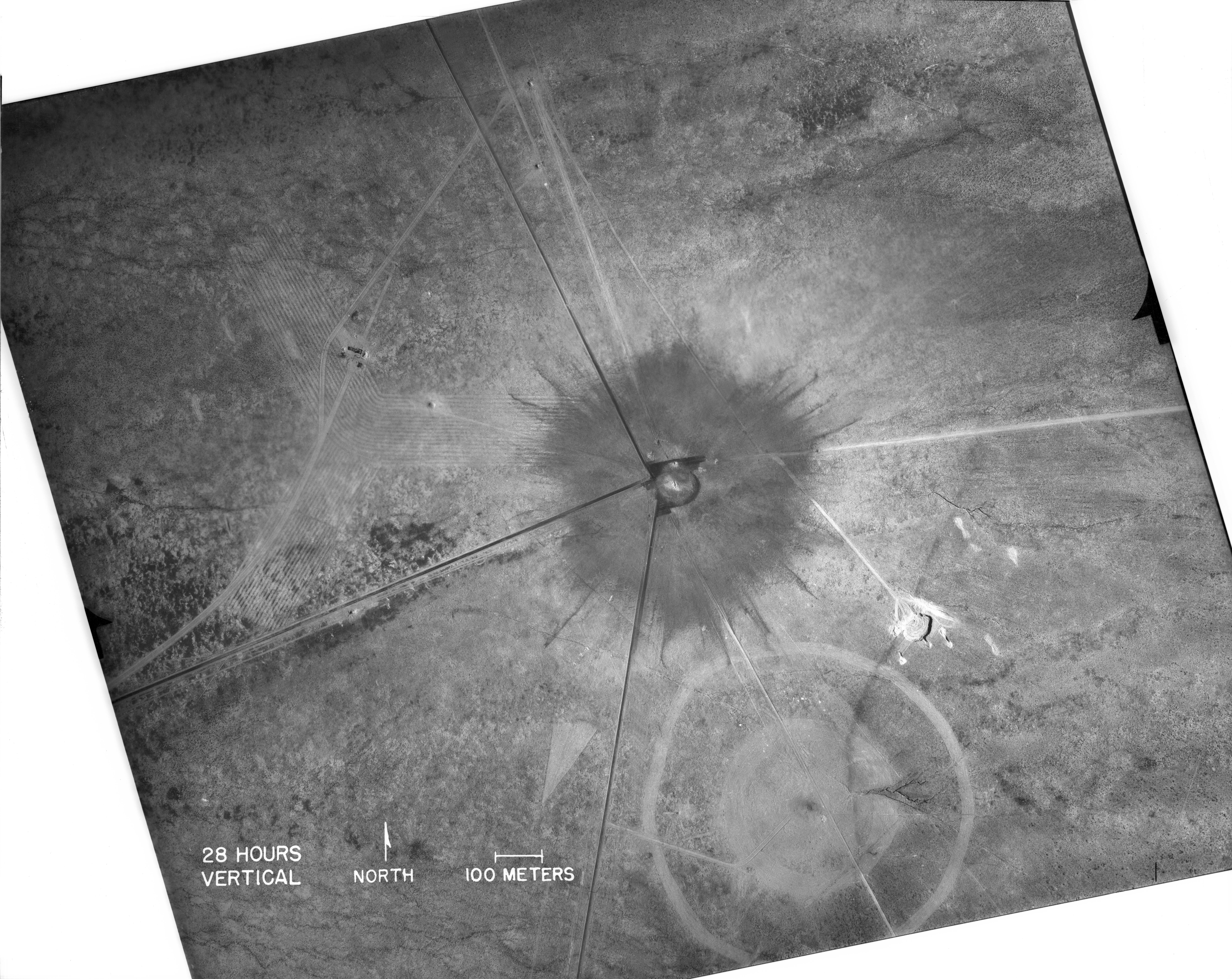
English: White Sands, New Mexico. Aerial view of the aftermath of the Trinity test, 28 hours after the explosion. The smaller crater to the southeast is from the earlier detonation of 100 tons of TNT on May 7, 1945. The dark straight lines are roads. To the left of the crater can be seen the "Jumbo" container, unharmed, and its collapsed tower (a vertical line). |
|
| Датум | ||
| Извор |
|
|
| Аутор | Federal government of the United States | |
| Остале верзије |
|
.jpg)
_2.jpg)
| This image is a work of a United States Department of Energy (or predecessor organization) employee, taken or made as part of that person's official duties. As a work of the U.S. federal government, the image is in the public domain.
Please note that national laboratories operate under varying licences and some are not free. Check the site policies of any national lab before crediting it with this tag.
|

|
Историја датотеке
Кликните на датум/време да бисте видели тадашњу верзију датотеке.
| Датум/време | Минијатура | Димензије | Корисник | Коментар | |
|---|---|---|---|---|---|
| тренутна | 18:03, 1. октобар 2016. | | 7.880 × 6.263 (6,33 MB) | Quibik | Higher-res from https://www.flickr.com/photos/losalamosnatlab/19282799141/in/album-72157652920995393/ |
| 20:52, 2. децембар 2005. |  | 800 × 685 (190 kB) | Fastfission~commonswiki | better version | |
| 20:45, 1. септембар 2005. |  | 472 × 315 (50 kB) | Fastfission~commonswiki | From en: Aerial view of the aftermath of the Trinity test. The smaller crater to the southeast is from the earlier detonation of 100 tons of TNT. Not sure about the scale but those dark straight lines are probably roads. Created as part of the [[Man |
Употреба датотеке
Следећа страница користи ову датотеку:
Глобална употреба датотеке
Други викији који користе ову датотеку:
- Употреба на cs.wikipedia.org
- Употреба на da.wikipedia.org
- Употреба на fi.wikipedia.org
- Употреба на ja.wikipedia.org
- Употреба на pt.wikipedia.org
- Употреба на ru.wikipedia.org
- Употреба на www.wikidata.org