
Датотека:2014-09-29 - Reichsbrücke-Donau City-Sunken City.jpg

Оригинална датотека (11.962 × 6.200 пиксела, величина датотеке: 27,13 MB, MIME тип: image/jpeg)
| Ово је датотека са Викимедијине оставе. Информације са њене странице са описом приказане су испод. Викимедијина остава је складиште слободно лиценциралних мултимедијалних датотека. И Ви можете да помогнете. |
Опис измене
| Опис |
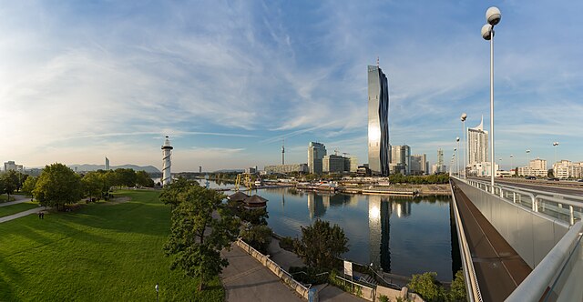
Deutsch: DC-Tower 1, Kaisermühlen - Donau City, Sunken City - Donauinsel - Copa Cagrana - Reichsbrücke, Vienna English: DC-Tower 1, Kaisermühlen - Donau City, Sunken City - Donauinsel - Copa Cagrana - Reichsbrücke, Vienna
|
|||||||||
| Датум | ||||||||||
| Извор | Сопствено дело | |||||||||
| Аутор |
Hubertl | |||||||||
| Ауторство (required by the license) | © Hubertl / Wikimedia Commons / | |||||||||
| Дозвола (Поновно коришћење ове датотеке) |
| |||||||||
| Assessments |
|
|||||||||
| Остале верзије | ||||||||||
| Location |
|


Лиценцирање
- Дозвољено је:
- да делите – да умножавате, расподељујете и преносите дело
- да прерађујете – да прерадите дело
- Под следећим условима:
- ауторство – Морате да дате одговарајуће заслуге, обезбедите везу ка лиценци и назначите да ли су измене направљене. Можете то урадити на било који разуман манир, али не на начин који предлаже да лиценцатор одобрава вас или ваше коришћење.
- делити под истим условима – Ако измените, преобразите или доградите овај материјал, морате поделити своје доприносе под истом или компатибилном лиценцом као оригинал.
| Annotations | This image is annotated: View the annotations at Commons |

.JPG)
Историја датотеке
Кликните на датум/време да бисте видели тадашњу верзију датотеке.
| Датум/време | Минијатура | Димензије | Корисник | Коментар | |
|---|---|---|---|---|---|
| тренутна | 23:40, 10. октобар 2014. | | 11.962 × 6.200 (27,13 MB) | Hubertl | Tilted lines straightened. |
| 11:43, 7. октобар 2014. |  | 11.962 × 6.200 (27,63 MB) | Hubertl | Complete revision (stitchingproblems solved) | |
| 20:55, 1. октобар 2014. |  | 11.153 × 5.274 (14,81 MB) | Hubertl | some small dustspots removed | |
| 14:49, 1. октобар 2014. |  | 11.153 × 5.274 (14,73 MB) | Hubertl |
Употреба датотеке
Следећа страница користи ову датотеку:
Глобална употреба датотеке
Други викији који користе ову датотеку:
- Употреба на ar.wikipedia.org
- Употреба на cs.wikipedia.org
- Употреба на de.wikipedia.org
- Употреба на de.wikivoyage.org
- Употреба на en.wikipedia.org
- Употреба на es.wikipedia.org
- Употреба на et.wikipedia.org
- Употреба на fr.wikipedia.org
- Употреба на hr.wikipedia.org
- Употреба на www.mediawiki.org
- Употреба на mg.wikipedia.org
- Употреба на nl.wikipedia.org
- Употреба на nl.wikinews.org
- Употреба на ru.wikinews.org
- Употреба на sk.wikipedia.org
- Употреба на www.wikidata.org