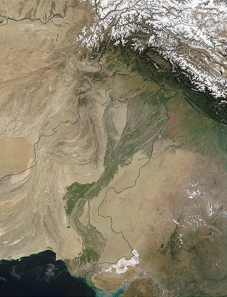
Датотека:Indus.A2002274.0610.1km.jpg
Appearance

Veličina ovog prikaza: 458 × 599 piksela. 5 drugih rezolucija: 183 × 240 piksela | 367 × 480 piksela | 587 × 768 piksela | 783 × 1.024 piksela | 1.300 × 1.700 piksela.
Originalna datoteka (1.300 × 1.700 piksela, veličina datoteke: 480 kB, MIME tip: image/jpeg)
Istorija datoteke
Kliknite na datum/vreme da biste videli tadašnju verziju datoteke.
| Datum/vreme | Minijatura | Dimenzije | Korisnik | Komentar | |
|---|---|---|---|---|---|
| trenutna | 15:03, 28. mart 2008. |  | 1.300 × 1.700 (480 kB) | File Upload Bot (Magnus Manske) | {{BotMoveToCommons|en.wikipedia}} {{Information |Description={{en|en:Satellite image of the en:Indus River basin. Red dots indicate fires. International boundaries are superimposed; the boundary through en:Jammu and Kashmir reflects the [[ |
Upotreba datoteke
Nema stranica koje koriste ovu datoteku.
Globalna upotreba datoteke
Drugi vikiji koji koriste ovu datoteku:
- Upotreba na af.wikipedia.org
- Upotreba na ar.wikipedia.org
- Upotreba na arz.wikipedia.org
- Upotreba na ast.wikipedia.org
- Upotreba na as.wikipedia.org
- Upotreba na azb.wikipedia.org
- Upotreba na az.wikipedia.org
- Upotreba na ba.wikipedia.org
- Upotreba na be-tarask.wikipedia.org
- Upotreba na bh.wikipedia.org
- Upotreba na bn.wikipedia.org
- Upotreba na bo.wikipedia.org
- Upotreba na br.wikipedia.org
- Upotreba na bxr.wikipedia.org
- Upotreba na ca.wikipedia.org
- Upotreba na ceb.wikipedia.org
- Upotreba na ce.wikipedia.org
- Upotreba na ckb.wikipedia.org
- Upotreba na cy.wikipedia.org
- Upotreba na da.wikipedia.org
- Upotreba na en.wikipedia.org
- Upotreba na eo.wikipedia.org
- Upotreba na es.wikipedia.org
- Upotreba na fa.wikipedia.org
- Upotreba na fiu-vro.wikipedia.org
- Upotreba na gd.wikipedia.org
- Upotreba na gl.wikipedia.org
- Upotreba na hi.wikipedia.org
- Upotreba na hy.wikipedia.org
- Upotreba na ia.wikipedia.org
- Upotreba na id.wikipedia.org
- Upotreba na ilo.wikipedia.org
- Upotreba na incubator.wikimedia.org
- Upotreba na is.wikipedia.org
- Upotreba na it.wikipedia.org
Još globalnog korišćenja ove datoteke.


