
Датотека:Poland & The New Baltic States.jpg
Veličina ovog prikaza: 462 × 599 piksela. 5 drugih rezolucija: 185 × 240 piksela | 370 × 480 piksela | 592 × 768 piksela | 790 × 1.024 piksela | 1.376 × 1.784 piksela.
Originalna datoteka (1.376 × 1.784 piksela, veličina datoteke: 1,22 MB, MIME tip: image/jpeg)
| Ovo je datoteka sa Vikimedijine ostave. Informacije sa njene stranice sa opisom prikazane su ispod. Vikimedijina ostava je skladište slobodno licenciralnih multimedijalnih datoteka. I Vi možete da pomognete. |
| Opis |
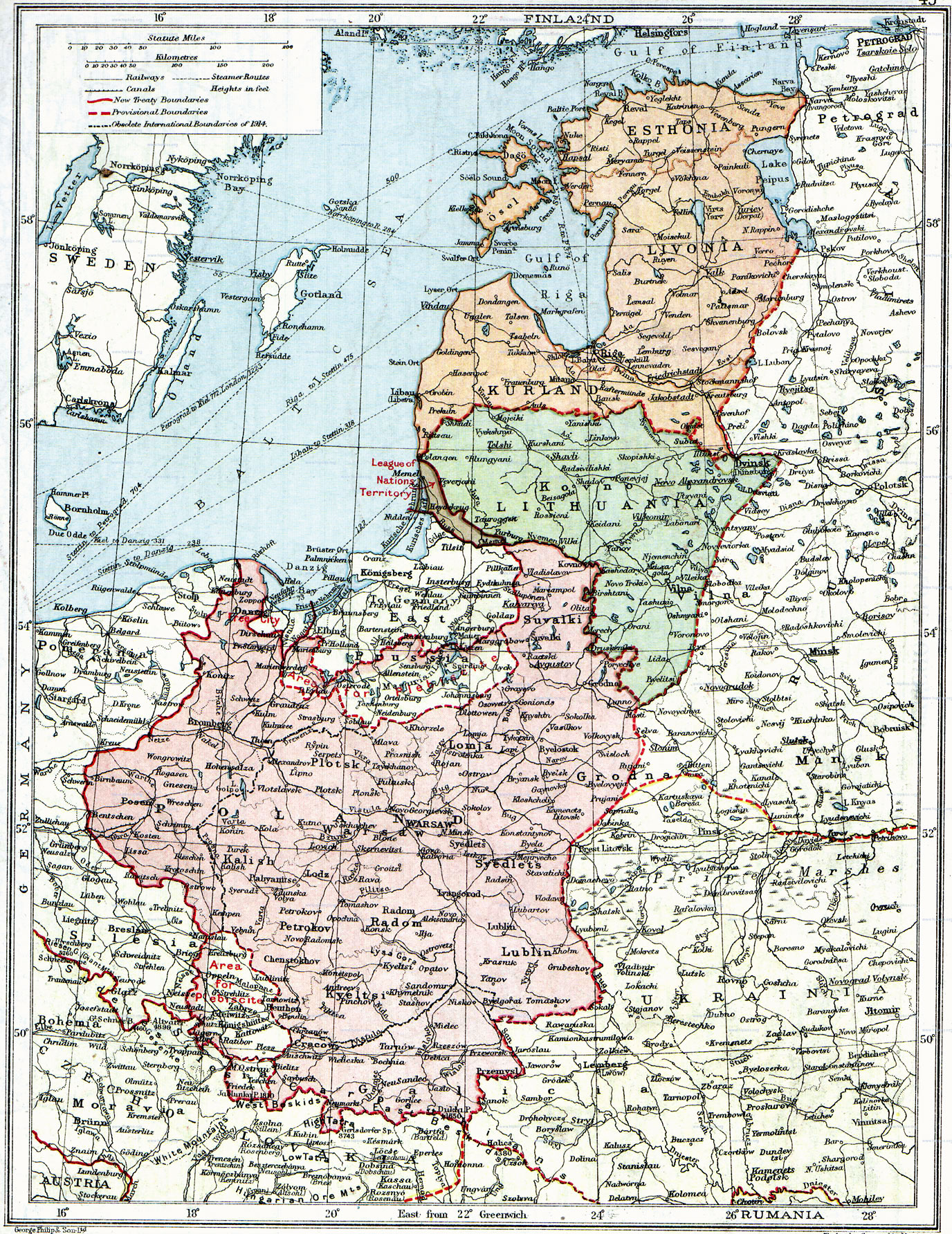
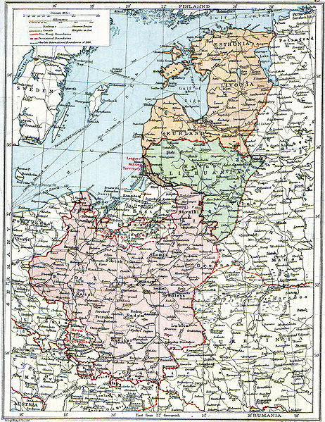
English: Map of Poland, en:Lithuania, en:Courland, en:Livonia and en:Esthonia published in the 1920 edition of The Peoples Atlas by London Geographical Institute.
The map shows the situation after the treaties of Versailles and Brest-Litovsk and before the en:Peace of Riga and the organization and recognition of the nation-states of en:Estonia and en:Latvia. Note that most names featured on this map are pre-1914 Russian names put in English transcription, rather than local or English names as such. |
| Datum | |
| Izvor |
This uploaded map is a photoshopped version of the original image located at Image:London-geographical-institute the-peoples-atlas 1920 poland-and-the-new-baltic-states.jpg or [1]. Originally uploaded to EN Wikipedia as en:Image:Poland & The New Baltic States.jpg by en:User:MaGioZal 26 December 2007 |
| Autor | London Geographical Institute |
| Dozvola (Ponovno korišćenje ove datoteke) |
According to the site, there are no copyrights to this map. |
| Ostale verzije | Image:London-geographical-institute the-peoples-atlas 1920 poland-and-the-new-baltic-states.jpg |
Ова мултимедијална датотека је у јавном власништву у Сједињеним Државама. Ово важи за радове америчких аутора где је истекло ауторско право, углавном због тога што је објављена пре 1. јануара 1929. За више информација погледајте ову страницу.
|
 | |
 |
Ова слика можда није у јавном власништу ван Сједињених Држава; ово нарочито важи за државе које не примењују правило краћег рока за америчке радове, као што су Канада, Кина (не Хонгконг и Макао), Немачка, Мексико и Швајцарска. Обавезно морате навести име аутора и годину објављивања. За више информација погледајте Википедија:Јавно власништво и Википедија:Ауторско право.
|
Istorija datoteke
Kliknite na datum/vreme da biste videli tadašnju verziju datoteke.
| Datum/vreme | Minijatura | Dimenzije | Korisnik | Komentar | |
|---|---|---|---|---|---|
| trenutna | 16:06, 26. jun 2010. | | 1.376 × 1.784 (1,22 MB) | Ras67 | losslessly cropped with Jpegcrop |
| 09:47, 3. avgust 2008. |  | 1.506 × 1.996 (1,28 MB) | Rcbutcher | {{Information |Description=Map of Poland, Lithuania, Courland, Livonia and Esthonia published in the 1920 edition of ''The Peoples Atlas'' by London Geographical Institute. The map shows the situation after the treaties of [[Treaty of |
Upotreba datoteke
2 sledeće stranice koriste ovu datoteku:
Globalna upotreba datoteke
Drugi vikiji koji koriste ovu datoteku:
- Upotreba na ar.wikipedia.org
- Upotreba na bat-smg.wikipedia.org
- Upotreba na ba.wikipedia.org
- Upotreba na ca.wikipedia.org
- Upotreba na da.wikipedia.org
- Upotreba na de.wikipedia.org
- Upotreba na en.wikipedia.org
- Upotreba na et.wikipedia.org
- Upotreba na fi.wikipedia.org
- Upotreba na fr.wikipedia.org
- Upotreba na gl.wikipedia.org
- Upotreba na it.wikipedia.org
- Upotreba na ja.wikipedia.org
- Upotreba na lt.wikipedia.org
- Upotreba na lt.wikibooks.org
- Upotreba na lv.wikipedia.org
- Upotreba na no.wikipedia.org
- Upotreba na ro.wikipedia.org
- Upotreba na ru.wikipedia.org
- Upotreba na sl.wikipedia.org
- Upotreba na sv.wikipedia.org
- Upotreba na tr.wikipedia.org
- Upotreba na uk.wikipedia.org
Još globalnog korišćenja ove datoteke.