
Датотека:Manistique Michigan aerial view.jpg

Величина овог приказа: 800 × 562 пиксела. 5 других резолуција: 320 × 225 пиксела | 640 × 449 пиксела | 1.024 × 719 пиксела | 1.280 × 899 пиксела | 1.500 × 1.053 пиксела.
Оригинална датотека (1.500 × 1.053 пиксела, величина датотеке: 601 kB, MIME тип: image/jpeg)
| Ово је датотека са Викимедијине оставе. Информације са њене странице са описом приказане су испод. Викимедијина остава је складиште слободно лиценциралних мултимедијалних датотека. И Ви можете да помогнете. |
| Опис |
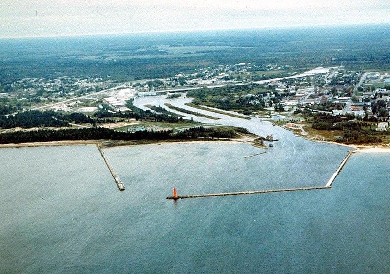
English: Aerial view of Manistique, Michigan, USA. The city lies on the northern shore of Lake Michigan in the Upper Peninsula of Michigan. The Manistique River flows through the town and into Lake Michigan through the harbor. |
|||
| Датум | not specified or unknown | |||
| Извор |
U.S. Army Corps of Engineers Digital Visual Library Image page Image description page Digital Visual Library home page |
|||
| Аутор | U.S. Army Corps of Engineers, photographer not specified or unknown | |||
| Дозвола (Поновно коришћење ове датотеке) |
|
|||
| Локација | Manistique, Schoolcraft County, Michigan, USA |
| Положај камере | | Ова и друге слике снимљене у близини на: OpenStreetMap |
|---|
Историја датотеке
Кликните на датум/време да бисте видели тадашњу верзију датотеке.
| Датум/време | Минијатура | Димензије | Корисник | Коментар | |
|---|---|---|---|---|---|
| тренутна | 03:30, 30. март 2007. | | 1.500 × 1.053 (601 kB) | DanMS | {{Information | Description = {{en|Aerial view of Manistique, Michigan, USA. The city lies on the northern shore of Lake Michigan in the Upper Peninsula of Michigan. The Manistique River flows through the town and into Lake Michigan through the harbor. |
Употреба датотеке
Следећа страница користи ову датотеку:
Глобална употреба датотеке
Други викији који користе ову датотеку:
- Употреба на ar.wikipedia.org
- Употреба на arz.wikipedia.org
- Употреба на azb.wikipedia.org
- Употреба на ceb.wikipedia.org
- Употреба на ce.wikipedia.org
- Употреба на cy.wikipedia.org
- Употреба на en.wikipedia.org
- Употреба на es.wikipedia.org
- Употреба на eu.wikipedia.org
- Употреба на fa.wikipedia.org
- Употреба на fr.wikipedia.org
- Употреба на hu.wikipedia.org
- Употреба на it.wikipedia.org
- Употреба на ky.wikipedia.org
- Употреба на lld.wikipedia.org
- Употреба на pl.wikipedia.org
- Употреба на pt.wikipedia.org
- Употреба на ro.wikipedia.org
- Употреба на sh.wikipedia.org
- Употреба на sv.wikipedia.org
- Употреба на tr.wikipedia.org
- Употреба на tt.wikipedia.org
- Употреба на uk.wikipedia.org
- Употреба на uz.wikipedia.org
- Употреба на www.wikidata.org
- Употреба на zh-min-nan.wikipedia.org
- Употреба на zh.wikipedia.org