
Датотека:Stillwater Minnesota waterfront aerial view.jpg

Величина овог приказа: 749 × 600 пиксела. 5 других резолуција: 300 × 240 пиксела | 600 × 480 пиксела | 959 × 768 пиксела | 1.279 × 1.024 пиксела | 1.500 × 1.201 пиксела.
Оригинална датотека (1.500 × 1.201 пиксела, величина датотеке: 1,05 MB, MIME тип: image/jpeg)
| Ово је датотека са Викимедијине оставе. Информације са њене странице са описом приказане су испод. Викимедијина остава је складиште слободно лиценциралних мултимедијалних датотека. И Ви можете да помогнете. |
| Опис |
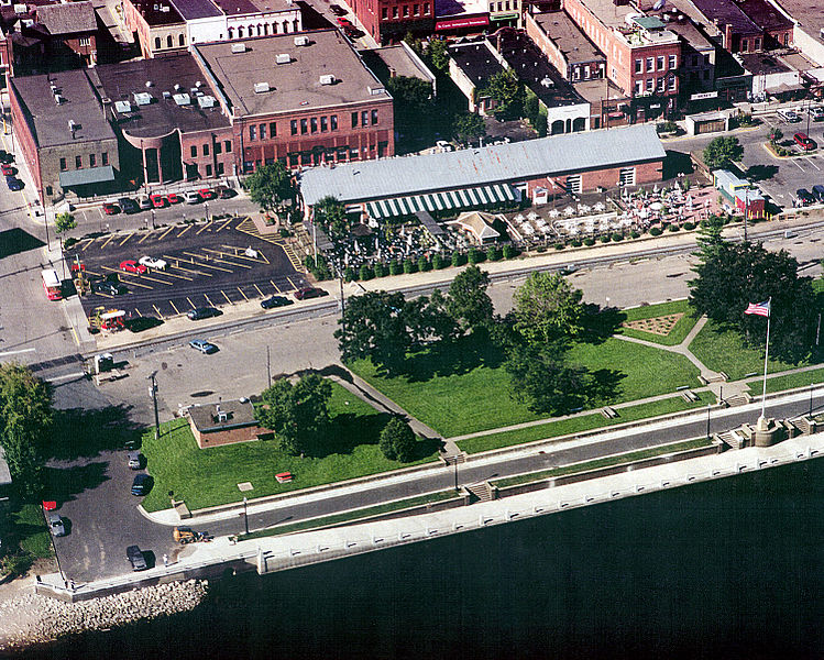
English: Aerial view of part of the waterfront section of Stillwater, Minnesota, USA, on the St. Croix River. View is to the west. The U.S. Army Corps of Engineers has constructed a floodwall along the waterfront. |
|||
| Датум | Taken on 24. август 1999. | |||
| Извор |
U.S. Army Corps of Engineers Digital Visual Library Image page Image description page Digital Visual Library home page |
|||
| Аутор | U.S. Army Corps of Engineers, photographer not specified or unknown | |||
| Дозвола (Поновно коришћење ове датотеке) |
|
|||
| Локација | Stillwater, Washington County, Minnesota, USA |
| Положај камере | | Ова и друге слике снимљене у близини на: OpenStreetMap |
|---|
Историја датотеке
Кликните на датум/време да бисте видели тадашњу верзију датотеке.
| Датум/време | Минијатура | Димензије | Корисник | Коментар | |
|---|---|---|---|---|---|
| тренутна | 02:08, 7. април 2007. | | 1.500 × 1.201 (1,05 MB) | DanMS | {{Information | Description = {{en|Aerial view of part of the waterfront section of Stillwater, Minnesota, USA, on the St. Croix River. View is to the west. The U.S. Army Corps of Engineers has constructed a floodwall along the waterfront.}} | |
Употреба датотеке
Следећа страница користи ову датотеку:
Глобална употреба датотеке
Други викији који користе ову датотеку:
- Употреба на ar.wikipedia.org
- Употреба на arz.wikipedia.org
- Употреба на azb.wikipedia.org
- Употреба на ca.wikipedia.org
- Употреба на ceb.wikipedia.org
- Употреба на ce.wikipedia.org
- Употреба на dag.wikipedia.org
- Употреба на en.wikipedia.org
- Употреба на en.wikivoyage.org
- Употреба на es.wikipedia.org
- Употреба на eu.wikipedia.org
- Употреба на fa.wikipedia.org
- Употреба на fi.wikipedia.org
- Употреба на fr.wikipedia.org
- Употреба на he.wikivoyage.org
- Употреба на ht.wikipedia.org
- Употреба на hu.wikipedia.org
- Употреба на ko.wikipedia.org
- Употреба на ky.wikipedia.org
- Употреба на lld.wikipedia.org
- Употреба на no.wikipedia.org
- Употреба на pl.wikipedia.org
- Употреба на ru.wikipedia.org
- Употреба на sh.wikipedia.org
- Употреба на sv.wikipedia.org
- Употреба на tr.wikipedia.org
- Употреба на tt.wikipedia.org
- Употреба на uk.wikipedia.org
- Употреба на uz.wikipedia.org
- Употреба на vi.wikipedia.org
- Употреба на vo.wikipedia.org
- Употреба на www.wikidata.org
- Употреба на zh-min-nan.wikipedia.org
- Употреба на zh.wikipedia.org