
Датотека:IndianTerritory.jpg
Величина овог приказа: 565 × 599 пиксела. 3 друге резолуције: 226 × 240 пиксела | 452 × 480 пиксела | 1.000 × 1.061 пиксела.
Оригинална датотека (1.000 × 1.061 пиксела, величина датотеке: 233 kB, MIME тип: image/jpeg)
| Ово је датотека са Викимедијине оставе. Информације са њене странице са описом приказане су испод. Викимедијина остава је складиште слободно лиценциралних мултимедијалних датотека. И Ви можете да помогнете. |
Опис
| Опис |
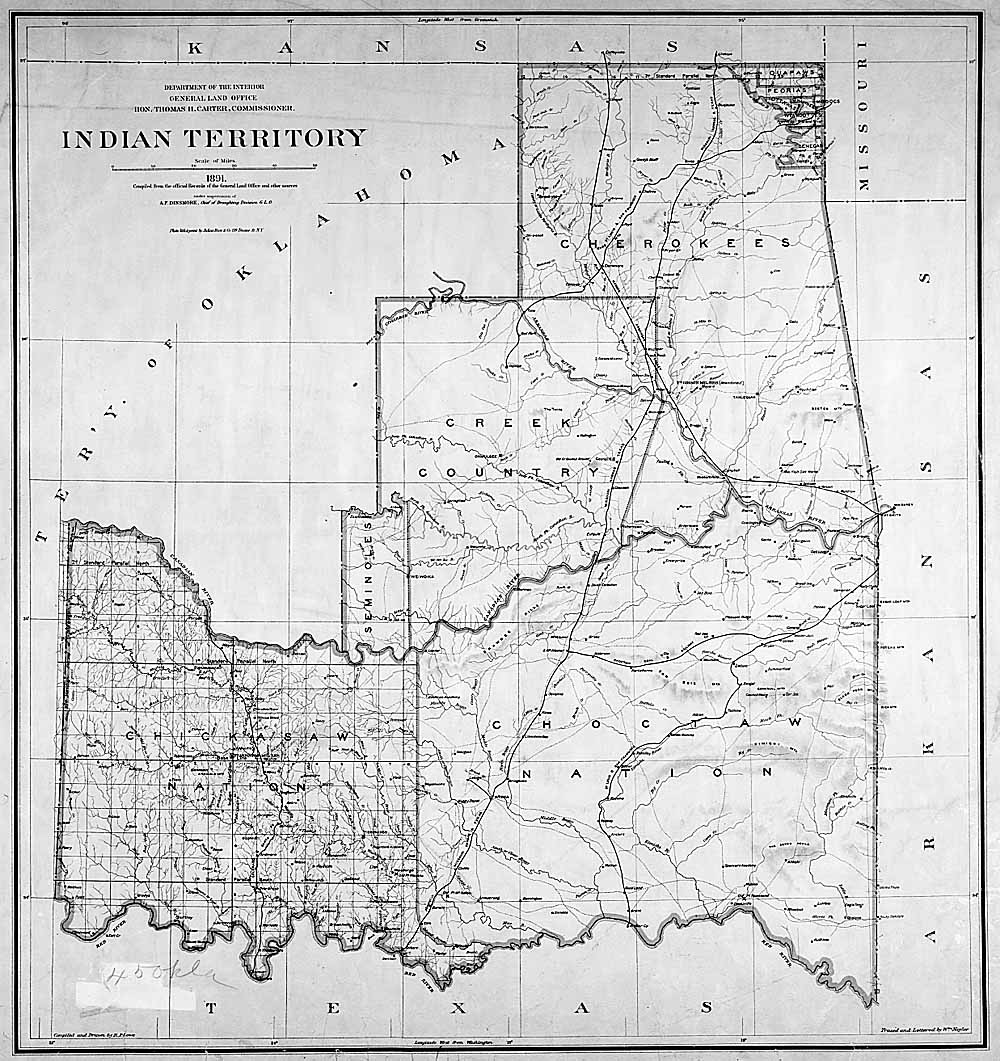
English: Map of Indian territory in Oklahoma in 1891. |
| Датум | |
| Извор |
National Archives Federal Indian Policy, direct image here. |
| Аутор | General Land Office, U.S. Department of the Interior |

|
Ова old map слика требало би да буду поново израђене као векторска графика у SVG формату. Тиме се остварује неколико предности. Више информација потражите на Commons:Media for cleanup. Ако је ова слика већ доступна у SVG формату, отпремите је. Након отпремања датотеке, овај шаблон замените шаблоном {{vector version available|new image name.svg}}.
|


Лиценцирање
| This image or media file contains material based on a work of a United States Department of the Interior employee, created as part of that person's official duties. As a work of the U.S. federal government, such work is in the public domain in the United States. See the Department of the Interior copyright policy for more information. |  |
This media is available in the holdings of the National Archives and Records Administration, cataloged under the National Archives Identifier (NAID) missing.
This tag does not indicate the copyright status of the attached work. A normal copyright tag is still required. See Commons:Licensing.
|
Првобитан дневник отпремања
Оригиналан опис странице је био овде. Сва наведена корисничка имена воде на en.wikipedia.
- 2004-04-17 03:33 RickK 500×531×8 (79801 bytes) From http://www.archives.gov/digital_classroom/lessons/federal_indian_policy/federal_indian_policy.html, federal government site, public domain
- 2004-04-17 03:32 RickK 500×531×8 (79801 bytes) From http://www.archives.gov/digital_classroom/lessons/federal_indian_policy/federal_indian_policy.html, federal government site, public domain
Историја датотеке
Кликните на датум/време да бисте видели тадашњу верзију датотеке.
| Датум/време | Минијатура | Димензије | Корисник | Коментар | |
|---|---|---|---|---|---|
| тренутна | 18:46, 5. јун 2011. | | 1.000 × 1.061 (233 kB) | Clindberg | Larger version from source |
| 18:26, 5. април 2008. |  | 500 × 531 (78 kB) | File Upload Bot (Magnus Manske) | {{BotMoveToCommons|en.wikipedia}} {{Information |Description={{en|From http://www.archives.gov/digital_classroom/lessons/federal_indian_policy/federal_indian_policy.html, federal government site, public domain [[:en:Category:Historical maps of the Unit |
Употреба датотеке
Следећа страница користи ову датотеку:
Глобална употреба датотеке
Други викији који користе ову датотеку:
- Употреба на ca.wikipedia.org
- Употреба на de.wikipedia.org
- Употреба на en.wikipedia.org
- Употреба на es.wikipedia.org
- Употреба на it.wikipedia.org
- Употреба на kk.wikipedia.org
- Употреба на mk.wikipedia.org
- Употреба на pl.wikipedia.org
- Употреба на pt.wikipedia.org
- Употреба на ru.wikipedia.org
- Употреба на uk.wikipedia.org