
Датотека:SeamontDavidson expedition bathymetric-2002.jpg
Већа резолуција није доступна.
SeamontDavidson_expedition_bathymetric-2002.jpg (600 × 478 пиксела, величина датотеке: 59 kB, MIME тип: image/jpeg)
| Ово је датотека са Викимедијине оставе. Информације са њене странице са описом приказане су испод. Викимедијина остава је складиште слободно лиценциралних мултимедијалних датотека. И Ви можете да помогнете. |
Опис измене
| Опис |
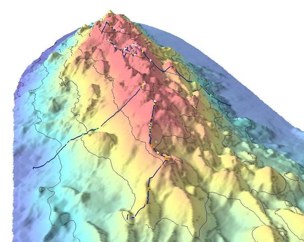
English: Bathymetric showing details of part of Davidson Seamount. The lines indicate the path of the 2002 expedition, and the dots signifigant coral nurseries
Français : Relevé bathymétrique montrant les détails du relief sous-marin du Mont Davidson. les lignes indiquent les lieux étudiés par l'expédition de 2002, et les points désignent les surseries coralliennes |
| Датум | import on Commons : 2010/10/30 |
| Извор | Direct link File page |
| Аутор | C. King/[1]/[2] |
| Дозвола (Поновно коришћење ове датотеке) |
The above two organizations are a part of NOAA; thus it is public domain (see below) |
Лиценцирање
This image is in the public domain because it contains materials that originally came from the U.S. National Oceanic and Atmospheric Administration, taken or made as part of an employee's official duties.
|
Историја датотеке
Кликните на датум/време да бисте видели тадашњу верзију датотеке.
| Датум/време | Минијатура | Димензије | Корисник | Коментар | |
|---|---|---|---|---|---|
| тренутна | 10:21, 30. октобар 2010. | | 600 × 478 (59 kB) | Lamiot | {{Information |Description= {{en|Bathymetric showing details of part of Davidson Seamount. The lines indicate the path of the 2002 expedition, and the dots signifigant coral nurseries}} {{fr|Relevé bathymétrique montrant les détails du relief sous-mari |
Употреба датотеке
Следећа страница користи ову датотеку:
Глобална употреба датотеке
Други викији који користе ову датотеку:
- Употреба на bs.wikipedia.org
- Употреба на en.wikipedia.org
- Употреба на fa.wikipedia.org
- Употреба на fr.wikipedia.org
- Употреба на gl.wikipedia.org
- Употреба на he.wikipedia.org
- Употреба на mk.wikipedia.org
- Употреба на nl.wikipedia.org
- Употреба на simple.wikipedia.org
- Употреба на th.wikipedia.org
- Употреба на tr.wikipedia.org
- Употреба на tt.wikipedia.org
- Употреба на www.wikidata.org