
Арабијско море — разлика између измена
#1Lib1Ref #1Lib1RefCEE |
. ознака: везе до вишезначних одредница |
||
| Ред 1: | Ред 1: | ||
{{rut}} |
|||
'''Арабијско море''' ('''Арапско море''') је северозападни део [[Индијски океан|Индијског океана]]. <ref name="британика 1">{{cite book |editor1-last=Мишић |editor1-first=Милан |title=Енциклопедија Британика. А-Б |date=2005 |publisher=Народна књига : Политика |location=Београд |isbn=86-331-2075-5 |pages=64}}</ref>Ограничавају га [[Индија]] на истоку, [[Пакистан]] на северу, Арабијско полуострво на западу, на југу његову границу представља линија између рта Гардафуј у [[Сомалија|Сомалијии]] рта Коморин на крајњем југу Индије. |
|||
{{Инфокутија водена површина |
|||
[[Датотека:Arapsko more.png|мини|220п|Арабијско море]] На северозападу се сужава у [[Омански залив]] који га повезује са [[Персијски залив|Персијским заливом]] преко [[Ормуски мореуз|Ормуског мореуза]], а на југозападу се сужава у [[Аденски залив]] који га повезује са [[Црвено море|Црвеним морем]] преко мореуза [[Баб ел Мандеб]]. |
|||
| име = Арабијско море |
|||
| изворни_назив = |
|||
| слика = Arabian Sea - n22e70.jpg |
|||
| опис_слике = |
|||
| image_bathymetry = Arabian Sea map.png |
|||
| alt_bathymetry = |
|||
| caption_bathymetry = |
|||
| државе = [[India]]<br>[[Iran]]<br>[[Maldives]]<br>[[Oman]]<br>[[Pakistan]]<br>[[Seychelles]]<br>[[Somalia]]<br>[[Sri Lanka]]<br>[[Yemen]] |
|||
| републике = |
|||
| покрајине = |
|||
| области = = |
|||
| регије = |
|||
| површина = {{convert|3862000|km2|sqmi|abbr=on}} (3,600,000 to 4,600,000 km2 in various sources) |
|||
| ширина = {{convert|2400|km|mi|abbr=on}} |
|||
| дужина = |
|||
| обала = |
|||
| запремина = |
|||
| просечна_дубина = |
|||
| највећа_дубина = {{convert|4652|m|ft|abbr=on}} |
|||
| басен = |
|||
| висина = |
|||
| салинитет = |
|||
| врста = море |
|||
| притоке = |
|||
| отоке = |
|||
| острва = [[Astola island]], [[Basavaraj Durga Island]], [[Lakshadweep]], [[Masirah Island]], [[Piram Island]], [[Pirotan]], [[Socotra]] |
|||
| градови = |
|||
| map = |
|||
| lat = 14 |
|||
| long = 65 |
|||
}} |
|||
'''Арабијско море''' (''Арапско море'', {{lang-ar| اَلْبَحرْ ٱلْعَرَبِيُّ|Al-Bahr al-ˁArabī}}) је северозападни део [[Индијски океан|Индијског океана]]. <ref name="британика 1">{{cite book |editor1-last=Мишић |editor1-first=Милан |title=Енциклопедија Британика. А-Б |date=2005 |publisher=Народна књига : Политика |location=Београд |isbn=86-331-2075-5 |pages=64}}</ref> Ограничавају га [[Индија]] на истоку, [[Пакистан]] на северу, Арабијско полуострво на западу, на југу његову границу представља линија између рта Гардафуј у [[Сомалија|Сомалији]]<ref>Pham, J. Peter. "Putting Somali piracy in context." Journal of Contemporary African Studies 28.3 (2010): 325-341.</ref> рта Коморин на крајњем југу Индије.<ref>Banse, Karl, and Charles R. McClain. "Winter blooms of phytoplankton in the Arabian Sea as observed by the Coastal Zone Color Scanner." Marine Ecology Progress Series (1986): 201-211.</ref> |
|||
Максимална ширина Арабијског мора је 2.400 -{km}-, а највећа дубина 4.562 -{m}-. [[Инд]] је највећа река која се улива у Бенгалски залив<ref name="британика 1" />, друге веће реке су Нармада, Тапти и Махи. Централни део индијске обале која излази на Арабијско море се назива „Конкан”, а јужни део се назива „Малабар”. Арабијско море је део важног пута између Европе и Азије преко [[Суецки канал|Суецског канала]]. |
|||
На северозападу се сужава у [[Омански залив]] који га повезује са [[Персијски залив|Персијским заливом]] преко [[Ормуски мореуз|Ормуског мореуза]], а на југозападу се сужава у [[Аденски залив]] који га повезује са [[Црвено море|Црвеним морем]] преко мореуза [[Баб ел Мандеб]]. |
|||
Земље које излазе на њега су Индија, Пакистан, [[Иран]], [[Оман]], [[Јемен]], [[Сомалија]] и [[Малдиви]]. Највећи градови на његовим обалама су [[Мумбај]] (бивши Бомбај), [[Сурат]], [[Мангалор]] и [[Кочи]] у Индији, [[Карачи]] и [[Гвадар]] у Пакистану, и [[Аден]] у Јемену. <ref name="британика 1" /> |
|||
Максимална ширина Арабијског мора је 2.400 -{km}-, а највећа дубина 4.562 -{m}-. [[Инд]] је највећа река која се улива у Бенгалски залив<ref name="британика 1" />, друге веће реке су Нармада, Тапти и Махи. Централни део индијске обале која излази на Арабијско море се назива „Конкан”, а јужни део се назива „Малабар”. Арабијско море је део важног пута између Европе и Азије преко [[Суецки канал|Суецског канала]]. Земље које излазе на њега су Индија, Пакистан, [[Иран]], [[Оман]], [[Јемен]], [[Сомалија]] и [[Малдиви]]. Највећи градови на његовим обалама су [[Мумбај]] (бивши Бомбај), [[Сурат]], [[Мангалор]] и [[Кочи]] у Индији, [[Карачи]] и [[Гвадар]] у Пакистану, и [[Аден]] у Јемену. <ref name="британика 1" /> Најпознатије плаже Арабијског мора су: плаже Карачија, плаже Гое, Јуху плаже код Мумбаја и Ковалам плажа код Керала. |
|||
Најпознатије плаже |
|||
Арабијског мора су: плаже Карачија, плаже Гое, Јуху плаже код Мумбаја и Ковалам плажа код Керала. |
|||
== Географија == |
|||
The Arabian Sea's surface area is about {{convert|3862000|km2|sqmi|-1|abbr=on}}.<ref name="Britannica">[https://www.britannica.com/EBchecked/topic/31653/Arabian-Sea Arabian Sea], Encyclopædia Britannica</ref> The maximum width of the sea is approximately {{convert|2400|km|mi|-1|abbr=on}}, and its maximum depth is {{convert|4652|m|ft|0}}. The biggest river flowing into the sea is the [[Indus River]]. |
|||
[[File:Bandra Sea Link aerial.jpg|thumb|left|250px| The aerial view of the Arabian Sea above Bombay/Mumbai, India]] |
|||
[[File:Arabian Sea in Karachi.jpg|thumb|right|250px|Arabian Sea in Karachi, Pakistan]] |
|||
The Arabian Sea has two important branches — the Gulf of Aden in the southwest, connecting with the Red Sea through the strait of [[Bab-el-Mandeb]]; and the Gulf of Oman to the northwest, connecting with the Persian Gulf. There are also the gulfs of [[Gulf of Khambhat|Khambhat]] and [[Gulf of Kutch|Kutch]] on the [[Coastal South West India|Indian Coast]]. |
|||
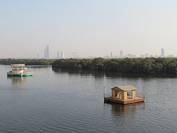
The Arabian Sea has been crossed by many important marine trade routes since the 3rd or 2nd millennium BCE. Major seaports include [[Kandla|Kandla Port]], [[Mundra Port]], [[Pipavav Port]], [[Dahej Port]], [[Hazira Port]], [[Mumbai Port Trust|Mumbai Port]], [[Jawaharlal Nehru Port|Nhava Sheva Port (Navi Mumbai)]], [[Mormugao|Mormugão Port (Goa)]], [[New Mangalore Port]] and [[Cochin Port|Kochi Port]] in India, the [[Port of Karachi]], [[Port Qasim]], and the [[Gwadar Port]] in Pakistan, [[Chabahar Port]] in Iran and the [[Port of Salalah]] in [[Salalah]], [[Oman]]. The largest islands in the Arabian Sea include [[Socotra]] ([[Yemen]]), [[Masirah Island]] (Oman), [[Lakshadweep]] (India) and [[Astola Island]] (Pakistan). |
|||
The countries with coastlines on the Arabian Sea are Yemen, Oman, Pakistan, Iran, India and the [[Maldives]].<ref name="Britannica"/> |
|||
===Limits=== |
|||
The [[International Hydrographic Organization]] defines the limits of the Arabian Sea as follows:<ref>{{cite web |url=https://iho.int/uploads/user/pubs/standards/s-23/S-23_Ed3_1953_EN.pdf |title=Limits of Oceans and Seas, 3rd edition |year=1953 |publisher=International Hydrographic Organization |access-date=28 December 2020|archive-url=https://web.archive.org/web/20171207191813/https://www.iho.int/iho_pubs/standard/S-23/S-23_Ed3_1953_EN.pdf |archive-date=7 December 2017 |pages=20–21}}</ref> |
|||
*On the west: the eastern limit of the Gulf of Aden. |
|||
*On the north: a line joining [[Ras al Hadd|Ràs al Hadd]], east point of the [[Arabian Peninsula]] (22°32'N) and [[Jiwani|Ràs Jiyùni]] (61°43'E) on the coast of Pakistan. |
|||
*On the south: a line running from the southern extremity of [[Addu Atoll]] in the Maldives, to the eastern extremity of [[Ras Hafun|Ràs Hafun]] (the easternmost point of [[Africa]], 10°26'N). |
|||
*On the east: the western limit of the Laccadive Sea a line running from [[Sadashivgad]] on the west coast of India ({{coord|14|48|N|74|07|E}}) to [[Cora Divh]] ({{coord|13|42|N|72|10|E}}) and thence down the west side of the [[Lakshadweep|Laccadive]] and Maldive archipelagos to the most southerly point of [[Addu Atoll]] in the Maldives. |
|||
== Пограничне земље и земље слива == |
|||
Border and basin countries:<ref>{{Cite CIA World Factbook|country=Iran}}</ref><ref>{{Cite web|url=http://www.wildlifeofpakistan.com/IntroductiontoPakistan/coastlineofPakistan.htm|title=Introduction to Pakistan: Section 5: Coastline|website=www.wildlifeofpakistan.com|access-date=2020-08-28|archive-date=2020-06-26|archive-url=https://web.archive.org/web/20200626173333/http://www.wildlifeofpakistan.com/IntroductiontoPakistan/coastlineofPakistan.htm|url-status=dead}}</ref> |
|||
#{{IND}} - 2.500 km обале |
|||
#{{PAK}} - 1.050 km обале |
|||
#{{ИРН}} |
|||
#{{МЛД}} |
|||
#{{ОМН}} |
|||
#{{YEM}} |
|||
#{{SOM}} |
|||
== Алтернативни називи == |
|||
The Arabian Sea historically and geographically has been referred to with different names by [[Arabian]] and European geographers and travelers, including [[Erythraean Sea]], Indian Sea, [[Oman sea]],<ref name=Kamat>{{cite web|url=http://www.kamat.com/indica/geography/arabian_sea.htm|title=Kamat's Potpourri: The Arabian Sea|work=kamat.com}}</ref> Erythraean, Persian Sea in para No 34-35 of the Voyage.<ref name=Periplus>{{cite web|url=http://depts.washington.edu/silkroad/texts/periplus/periplus.html|title=The Voyage around the Erythraean Sea|work=washington.edu}}</ref> In Indian folklore, it is referred to as Darya, Sindhu Sagar, and Arab Samudra.<ref>{{Cite web|url=http://www.kamat.com/indica/geography/arabian_sea.htm|title=Kamat's Potpourri: The Arabian Sea|website=www.kamat.com}}</ref><ref>{{Cite web|url=http://depts.washington.edu/silkroad/texts/periplus/periplus.html|title=The Voyage around the Erythraean Sea|website=depts.washington.edu}}</ref><ref name="auto">{{Cite web |url=http://www.scribd.com/doc/8583367/The-Periplus-of-the-Erythraean-Sea |title=The Periplus of the Erythraean Sea |access-date=2012-04-03 |archive-date=2013-12-02 |archive-url=https://web.archive.org/web/20131202223335/http://www.scribd.com/doc/8583367/The-Periplus-of-the-Erythraean-Sea |url-status=dead }}</ref> |
|||
Arab geographers, sailors and nomads used to call this sea by different names, including the Akhzar (Green) Sea, Bahre Fars (Persian Sea), the Ocean Sea, the Hindu sea, the Makran Sea, the sea of Oman; among them [[Zakariya al-Qazwini]], [[Al-Masudi]], [[Ibn Hawqal]] and [[Hafiz-i Abru]]. They wrote: "The green sea and Indian sea and Persian sea are all one sea and in this sea there are strange creatures." in Iran and Turkey people call it Oman sea.<ref name=MFA>{{cite web|url=https://japan.mfa.gov.ir/en/newsview/536034|title=Ministry of MoFA Iran: Introducing a Book and Atlas|work=mfa.gov.ir}}</ref> |
|||
In the [[Periplus of the Erythraean Sea]], as well as in some ancient maps, Erythraean Sea refers to the whole area of the northwestern Indian Ocean, including the Arabian Sea.<ref>{{cite web| url = http://commons.wikimedia.org/wiki/File:1794_Anville_Map_of_the_Ancient_World_-_Geographicus_-_AncientWorld-anville-1794.jpg| title = 1794, Orbis Veteribus Notus by Jean Baptiste Bourguignon d'Anville| year = 1794}}</ref> |
|||
<gallery mode="packed"> |
|||
File:A horizontal Malabar Coast miniature, a reprint by Petrus Bertius, 1630.jpg|A horizontal Malabar Coast miniature, a reprint by [[Petrus Bertius]], 1630 |
|||
File:Basra-ps64.JPG|Persian Sea |
|||
File:Asia in the shape of the mythical winged horse Pegasus..jpg|Asia. [[Sinus Persicus]] and the Mare Persicum |
|||
File:Map of persia.jpg|Iran and [[Makran]] |
|||
File:Soulier, E.; Andriveau-Goujon, J. Anciens Empires Jusqua Alexandre. 1838.jpg|[[Erythraean Sea]] 1838. |
|||
File:1658 Jansson Map of the Indian Ocean (Erythrean Sea) in Antiquity - Geographicus - ErythraeanSea-jansson-1658.jpg|1658 [[Jan Janssonius|Jansson]] Map of the Indian Ocean ([[Erythraean Sea]]) |
|||
File:The western part of the Indian Ocean, by Vincenzo Maria Coronelli, 1693, from his system of global gores the south.jpg|The western part of the Indian Ocean,1693 |
|||
</gallery> |
|||
==Oxygen minimum zone== |
|||
[[File:Winter Phytoplankon Arabian Sea.jpg|alt=Phytoplankton bloom over the Arabian Sea|thumb|250px|Phytoplankton bloom over the Arabian Sea in winter (NASA)]] |
|||
The Arabian Sea has one of the world's three largest oceanic [[oxygen minimum zone]]s (OMZ), or “dead zones,” along with the eastern tropical North Pacific and the eastern tropical South Pacific. OMZs have very low levels of [[oxygen]], sometimes undetectable by standard equipment.<ref>{{Cite journal|last1=Lüke|first1=Claudia|last2=Speth|first2=Daan R.|last3=Kox|first3=Martine A. R.|last4=Villanueva|first4=Laura|last5=Jetten|first5=Mike S. M.|date=2016-04-07|title=Metagenomic analysis of nitrogen and methane cycling in the Arabian Sea oxygen minimum zone|url=https://peerj.com/articles/1924|journal=PeerJ|language=en|volume=4|pages=e1924|doi=10.7717/peerj.1924|issn=2167-8359|pmc=4830246|pmid=27077014}}</ref> The Arabian Sea's OMZ has the lowest levels of oxygen in the world, especially in the Gulf of Oman.<ref>{{Cite journal|last1=Queste|first1=Bastien Y.|last2=Vic|first2=Clément|last3=Heywood|first3=Karen J.|last4=Piontkovski|first4=Sergey A.|date=2018|title=Physical Controls on Oxygen Distribution and Denitrification Potential in the North West Arabian Sea|journal=Geophysical Research Letters|language=en|volume=45|issue=9|pages=4143–4152|doi=10.1029/2017GL076666|bibcode=2018GeoRL..45.4143Q|issn=1944-8007|doi-access=free}}</ref> Causes of the OMZ may include untreated sewage as well as high temperatures on the Indian subcontinent, which increase winds blowing towards India, bringing up nutrients and reducing oxygen in the Arabian Sea's waters. In winter, phytoplankton suited to low-oxygen conditions turn the OMZ bright green.<ref>{{Cite news|last=Bhanoo|first=S.N.|title=A Green Blanket on the Arabian Sea|work=The New York Times}}</ref> |
|||
==Arabian Sea warming== |
|||
Recent studies<ref>{{cite journal |last1=Roxy |first1=Mathew Koll |last2=Ritika |first2=Kapoor |last3=Terray |first3=Pascal |last4=Murtugudde |first4=Raghu |last5=Ashok |first5=Karumuri |last6=Goswami |first6=B. N. |title=Drying of Indian subcontinent by rapid Indian Ocean warming and a weakening land-sea thermal gradient |journal=Nature Communications |date=16 June 2015 |volume=6 |issue=1 |pages=7423 |doi=10.1038/ncomms8423 |pmid=26077934 |bibcode=2015NatCo...6.7423R |s2cid=7061499 |language=en |issn=2041-1723|doi-access=free }}</ref><ref>{{cite journal |last1=Pratik |first1=Kad |last2=Parekh |first2=Anant |last3=Karmakar |first3=Ananya |last4=Chowdary |first4=Jasti S. |last5=Gnanaseelan |first5=C. |title=Recent changes in the summer monsoon circulation and their impact on dynamics and thermodynamics of the Arabian Sea |journal=Theoretical and Applied Climatology |date=1 April 2019 |volume=136 |issue=1 |pages=321–331 |doi=10.1007/s00704-018-2493-6 |bibcode=2019ThApC.136..321P |s2cid=126114281 |url=https://link.springer.com/article/10.1007/s00704-018-2493-6 |language=en |issn=1434-4483}}</ref><ref>{{cite book |last1=Roxy |first1=M. K. |last2=Gnanaseelan |first2=C. |last3=Parekh |first3=Anant |last4=Chowdary |first4=Jasti S. |last5=Singh |first5=Shikha |last6=Modi |first6=Aditi |last7=Kakatkar |first7=Rashmi |last8=Mohapatra |first8=Sandeep |last9=Dhara |first9=Chirag |last10=Shenoi |first10=S. C. |last11=Rajeevan |first11=M. |title=Assessment of Climate Change over the Indian Region: A Report of the Ministry of Earth Sciences (MoES), Government of India |date=2020 |publisher=Springer |isbn=978-981-15-4327-2 |pages=191–206 |url=https://link.springer.com/chapter/10.1007/978-981-15-4327-2_10 |language=en |chapter=Indian Ocean Warming|doi=10.1007/978-981-15-4327-2_10 |s2cid=226643638 }}</ref> by [[Indian Institute of Tropical Meteorology]] confirmed that the Arabian Sea is warming monotonously; it possibly is due to by global warming. |
|||
==Underwater tunnel== |
|||
A rail tunnel under the sea is planned. It will link the UAE with the western coast of India. The tunnel will be supported by pontoons and will be nearly 2000 kilometres in length.<ref>{{Cite web|url=https://timesofindia.indiatimes.com/travel/destinations/a-2000-km-long-underwater-rail-will-connect-mumbai-to-the-uae-very-soon/amp_articleshow/66878629.cms|title = A 2,000-km-long underwater rail will connect Mumbai to the UAE very soon! | Times of India Travel|website = [[The Times of India]]}}</ref> |
|||
<ref>{{Cite web|url=https://futurism.com/united-arab-emirates-underwater-bullet-train-india/amp|title=The UAE wants an underwater bullet train to India|date=5 December 2018}}</ref> |
|||
== Environment and wildlife == |
|||
The wildlife of the Arabian sea is diverse, and entirely unique because of the geographic distribution. |
|||
<gallery mode="packed" widths="250px" heights="180px"> |
|||
File:The western part of the Indian Ocean, by Vincenzo Maria Coronelli, 1693 from his system of global gores the Makran coast.jpg|The western part of the Indian Ocean, by Vincenzo Maria Coronelli, 1693 from his system of global gores the Makran coast |
|||
File:Karachi Mangroves.jpg|Mangrove forests are abundant south of Karachi, Pakistan |
|||
File:Nakhl-Minoo.jpg|[[Arecaceae|Palm]] and [[sunset]] in [[Minoo Island]], Iran. |
|||
File:The-Worlds-Most-Isolated-and-Distinct-Whale-Population-Humpback-Whales-of-the-Arabian-Sea-pone.0114162.s001.tif|Critically endangered |
|||
File:Dugong.jpg|[[Dugong]] mother and her offspring in shallow waters. |
|||
File:Makran sea .makoran coast in Iran.jpg|Makran coast |
|||
File:Makoran sea .Makoran coast in Iran.jpg|Makran sea .Makoran coast in Iran |
|||
File:Red Coast of Makoran sea Iran.jpg|Makran coast |
|||
File:Arabian or Makoran sea .Makoran red coast in Iran.jpg|Iran |
|||
</gallery> |
|||
== Референце == |
|||
{{Reflist}} |
|||
== Литература == |
|||
{{refbegin|30em}} |
|||
* {{Cite web|date=May 17, 2021|title=Cyclone Tauktae Strikes India|url=https://earthobservatory.nasa.gov/images/148325/cyclone-tauktae-strikes-india|access-date=June 5, 2021|website=earthobservatory.nasa.gov}} |
|||
* {{Cite web|title=Activities of RSMC, New Delhi|url=http://www.rsmcnewdelhi.imd.gov.in/activities-of-rsmc-new-delhi.php|access-date=June 5, 2021|website=www.rsmcnewdelhi.imd.gov.in}} |
|||
* {{Cite web|title=2021 North Indian Ocean Cyclone Season|url=https://disasterphilanthropy.org/disaster/2021-north-indian-ocean-cyclone-season/|url-status=live|access-date=June 5, 2021|website=disasterphilanthropy.org}} |
|||
* {{Cite web|title=Acronyms|url=http://www.rsmcnewdelhi.imd.gov.in/acronyms.php|access-date=June 5, 2021|website=www.rsmcnewdelhi.imd.gov.in}} |
|||
* {{cite web|url=https://www.metoc.navy.mil/jtwc/products/io0221web.txt|title=TROPICAL CYCLONE 02B (TWO) WARNING NR 001|website=www.metoc.navy.mil|author= |publisher=Joint Typhoon Warning Center|location=Pearl Harbour, Hawaii|date=May 24, 2021|access-date=May 24, 2021|archive-url=https://web.archive.org/web/20210524042107/https://www.metoc.navy.mil/jtwc/products/io0221web.txt|archive-date=May 24, 2021}} |
|||
* {{Cite web|title=Bay of Bengal {{!}} bay, Indian Ocean|url=https://www.britannica.com/place/Bay-of-Bengal|access-date=June 3, 2021|website=Encyclopædia Britannica}} |
|||
* {{Cite web|date=May 26, 2021|title=Why Bay of Bengal is hotbed of worst tropical cyclones? As Yaas hits Odisha, here's all you need to know|url=https://www.financialexpress.com/lifestyle/science/why-bay-of-bengal-is-hotbed-of-worst-tropical-cyclones-as-yaas-hits-odisha-heres-all-you-need-to-know/2259192/|access-date=June 5, 2021|website=The Financial Express}} |
|||
* {{Cite web|title=Frequently Asked Questions on Tropical Cyclones|url=http://www.rsmcnewdelhi.imd.gov.in/images/pdf/faq.pdf|url-status=live|access-date=May 31, 2021|website=IMD}} |
|||
* {{cite web|url=https://www.metoc.navy.mil/jtwc/products/io0121web.txt|title=TROPICAL CYCLONE 01A (ONE) WARNING NR 001|website=www.metoc.navy.mil|author= |publisher=Joint Typhoon Warning Center|location=Pearl Harbour, Hawaii|date=May 14, 2021|access-date=May 14, 2021|archive-url=https://web.archive.org/web/20210514100035/https://www.metoc.navy.mil/jtwc/products/io0121web.txt|archive-date=May 14, 2021}} |
|||
* {{Cite web|date=April 10, 2011|title=History of cyclones in the Arabian sea|url=https://pakistanweatherportal.com/2011/04/10/history-of-cyclones-in-the-arabian-sea/|access-date=May 30, 2021|website=Pakistan Weather Portal (PWP)}} |
|||
* {{Cite web|date=June 7, 2007|title=Tropical Cyclone Gonu|url=https://earthobservatory.nasa.gov/images/18446/tropical-cyclone-gonu|access-date=May 30, 2021|website=earthobservatory.nasa.gov}} |
|||
* {{cite report|url=http://www.rsmcnewdelhi.imd.gov.in/images/pdf/archive/best-track/bestrack.pdf|title=Best track data of tropical cyclonic disturbances over the north Indian Ocean|date=July 14, 2009|publisher=India Meteorological Department|access-date=October 31, 2015}} |
|||
* {{cite report|url=http://www.rsmcnewdelhi.imd.gov.in/images/pdf/archive/rsmc/2004.pdf|date=January 2005|page=2|archive-url=https://web.archive.org/web/20150402104124/http://www.rsmcnewdelhi.imd.gov.in/images/pdf/archive/rsmc/2004.pdf|title=Report on Cyclonic Disturbances over North Indian Ocean during 2014|author=RSMC — Tropical Cyclones New Delhi|archive-date=April 2, 2015|url-status=live}} |
|||
* {{cite conference|page=10|url=https://www.wmo.int/pages/prog/www/tcp/documents/3JS_Reportdraft_FINAL.pdf|title=Third Joint Session of Panel on Tropical Cyclones & Typhoon Committee February 9–13, 2015|location=Bangkok, Thailand|url-status=live|archive-date=April 19, 2016|publisher=World Meteorological Organization|archive-url=https://web.archive.org/web/20160419055649/https://www.wmo.int/pages/prog/www/tcp/documents/3JS_Reportdraft_FINAL.pdf}} |
|||
* {{Cite journal|last1=Wang|first1=Shih-Yu|last2=Buckley|first2=Brendan M.|last3=Yoon|first3=Jin-Ho|last4=Fosu|first4=Boniface|date=2013|title=Intensification of premonsoon tropical cyclones in the Bay of Bengal and its impacts on Myanmar|journal=Journal of Geophysical Research: Atmospheres|volume=118|issue=10|pages=4373–4384|doi=10.1002/jgrd.50396|bibcode=2013JGRD..118.4373W |issn=2169-8996|doi-access=free}} |
|||
{{refend}} |
|||
== Спољашње везе == |
== Спољашње везе == |
||
{{Commonscat|Arabian Sea}} |
{{Commonscat|Arabian Sea}} |
||
* [https://web.archive.org/web/20110523064712/http://wwf.panda.org/about_our_earth/ecoregions/arabian_sea.cfm Арабијско море (World Wildlife Fund)] |
* [https://web.archive.org/web/20110523064712/http://wwf.panda.org/about_our_earth/ecoregions/arabian_sea.cfm Арабијско море (World Wildlife Fund)] |
||
* [https://japan.mfa.gov.ir/en/newsview/536034 A book and Atlas] |
|||
{{Светско море}} |
{{Светско море}} |
||
Верзија на датум 15. фебруар 2023. у 17:31
Један корисник управо ради на овом чланку. Молимо остале кориснике да му допусте да заврши са радом. Ако имате коментаре и питања у вези са чланком, користите страницу за разговор.
Хвала на стрпљењу. Када радови буду завршени, овај шаблон ће бити уклоњен. Напомене
|
| Арабијско море | |
|---|---|
 | |
 | |
| Локација | = |
| Координате | 14° С; 65° И / 14° С; 65° И |
| Тип | море |
| Земље басена | India Iran Maldives Oman Pakistan Seychelles Somalia Sri Lanka Yemen |
| Макс. ширина | 2.400 km (1.500 mi) km |
| Површина | 3.862.000 km2 (1.491.000 sq mi) (3,600,000 to 4,600,000 km2 in various sources) km2 |
| Макс. дубина | 4.652 m (15.262 ft) m |
| Острва | Astola island, Basavaraj Durga Island, Lakshadweep, Masirah Island, Piram Island, Pirotan, Socotra |
| Водена површина на Викимедијиној остави | |
Арабијско море (Арапско море, арап. اَلْبَحرْ ٱلْعَرَبِيُّ) је северозападни део Индијског океана. [1] Ограничавају га Индија на истоку, Пакистан на северу, Арабијско полуострво на западу, на југу његову границу представља линија између рта Гардафуј у Сомалији[2] рта Коморин на крајњем југу Индије.[3]
На северозападу се сужава у Омански залив који га повезује са Персијским заливом преко Ормуског мореуза, а на југозападу се сужава у Аденски залив који га повезује са Црвеним морем преко мореуза Баб ел Мандеб.
Максимална ширина Арабијског мора је 2.400 km, а највећа дубина 4.562 m. Инд је највећа река која се улива у Бенгалски залив[1], друге веће реке су Нармада, Тапти и Махи. Централни део индијске обале која излази на Арабијско море се назива „Конкан”, а јужни део се назива „Малабар”. Арабијско море је део важног пута између Европе и Азије преко Суецског канала. Земље које излазе на њега су Индија, Пакистан, Иран, Оман, Јемен, Сомалија и Малдиви. Највећи градови на његовим обалама су Мумбај (бивши Бомбај), Сурат, Мангалор и Кочи у Индији, Карачи и Гвадар у Пакистану, и Аден у Јемену. [1] Најпознатије плаже Арабијског мора су: плаже Карачија, плаже Гое, Јуху плаже код Мумбаја и Ковалам плажа код Керала.
Географија
The Arabian Sea's surface area is about 3.862.000 km2 (1.491.130 sq mi).[4] The maximum width of the sea is approximately 2.400 km (1.490 mi), and its maximum depth is 4.652 m (15.262 ft). The biggest river flowing into the sea is the Indus River.


The Arabian Sea has two important branches — the Gulf of Aden in the southwest, connecting with the Red Sea through the strait of Bab-el-Mandeb; and the Gulf of Oman to the northwest, connecting with the Persian Gulf. There are also the gulfs of Khambhat and Kutch on the Indian Coast. The Arabian Sea has been crossed by many important marine trade routes since the 3rd or 2nd millennium BCE. Major seaports include Kandla Port, Mundra Port, Pipavav Port, Dahej Port, Hazira Port, Mumbai Port, Nhava Sheva Port (Navi Mumbai), Mormugão Port (Goa), New Mangalore Port and Kochi Port in India, the Port of Karachi, Port Qasim, and the Gwadar Port in Pakistan, Chabahar Port in Iran and the Port of Salalah in Salalah, Oman. The largest islands in the Arabian Sea include Socotra (Yemen), Masirah Island (Oman), Lakshadweep (India) and Astola Island (Pakistan). The countries with coastlines on the Arabian Sea are Yemen, Oman, Pakistan, Iran, India and the Maldives.[4]
Limits
The International Hydrographic Organization defines the limits of the Arabian Sea as follows:[5]
- On the west: the eastern limit of the Gulf of Aden.
- On the north: a line joining Ràs al Hadd, east point of the Arabian Peninsula (22°32'N) and Ràs Jiyùni (61°43'E) on the coast of Pakistan.
- On the south: a line running from the southern extremity of Addu Atoll in the Maldives, to the eastern extremity of Ràs Hafun (the easternmost point of Africa, 10°26'N).
- On the east: the western limit of the Laccadive Sea a line running from Sadashivgad on the west coast of India (14° 48′ N 74° 07′ E / 14.800° С; 74.117° И) to Cora Divh (13° 42′ N 72° 10′ E / 13.700° С; 72.167° И) and thence down the west side of the Laccadive and Maldive archipelagos to the most southerly point of Addu Atoll in the Maldives.
Пограничне земље и земље слива
Border and basin countries:[6][7]
Алтернативни називи
The Arabian Sea historically and geographically has been referred to with different names by Arabian and European geographers and travelers, including Erythraean Sea, Indian Sea, Oman sea,[8] Erythraean, Persian Sea in para No 34-35 of the Voyage.[9] In Indian folklore, it is referred to as Darya, Sindhu Sagar, and Arab Samudra.[10][11][12]
Arab geographers, sailors and nomads used to call this sea by different names, including the Akhzar (Green) Sea, Bahre Fars (Persian Sea), the Ocean Sea, the Hindu sea, the Makran Sea, the sea of Oman; among them Zakariya al-Qazwini, Al-Masudi, Ibn Hawqal and Hafiz-i Abru. They wrote: "The green sea and Indian sea and Persian sea are all one sea and in this sea there are strange creatures." in Iran and Turkey people call it Oman sea.[13] In the Periplus of the Erythraean Sea, as well as in some ancient maps, Erythraean Sea refers to the whole area of the northwestern Indian Ocean, including the Arabian Sea.[14]
-
 A horizontal Malabar Coast miniature, a reprint by Petrus Bertius, 1630
 -
 Persian Sea
 -
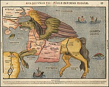 Asia. Sinus Persicus and the Mare Persicum
 -
 Iran and Makran
 -
 Erythraean Sea 1838.
 -
 1658 Jansson Map of the Indian Ocean (Erythraean Sea)
 -
 The western part of the Indian Ocean,1693


_in_Antiquity_-_Geographicus_-_ErythraeanSea-jansson-1658.jpg)

Oxygen minimum zone

The Arabian Sea has one of the world's three largest oceanic oxygen minimum zones (OMZ), or “dead zones,” along with the eastern tropical North Pacific and the eastern tropical South Pacific. OMZs have very low levels of oxygen, sometimes undetectable by standard equipment.[15] The Arabian Sea's OMZ has the lowest levels of oxygen in the world, especially in the Gulf of Oman.[16] Causes of the OMZ may include untreated sewage as well as high temperatures on the Indian subcontinent, which increase winds blowing towards India, bringing up nutrients and reducing oxygen in the Arabian Sea's waters. In winter, phytoplankton suited to low-oxygen conditions turn the OMZ bright green.[17]
Arabian Sea warming
Recent studies[18][19][20] by Indian Institute of Tropical Meteorology confirmed that the Arabian Sea is warming monotonously; it possibly is due to by global warming.
Underwater tunnel
A rail tunnel under the sea is planned. It will link the UAE with the western coast of India. The tunnel will be supported by pontoons and will be nearly 2000 kilometres in length.[21] [22]
Environment and wildlife
The wildlife of the Arabian sea is diverse, and entirely unique because of the geographic distribution.
-
 The western part of the Indian Ocean, by Vincenzo Maria Coronelli, 1693 from his system of global gores the Makran coast
 -
 Mangrove forests are abundant south of Karachi, Pakistan
 -

-
 Critically endangered
 -
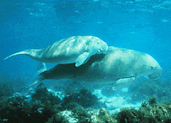 Dugong mother and her offspring in shallow waters.
 -
 Makran coast
 -
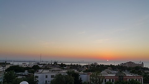 Makran sea .Makoran coast in Iran
 -
 Makran coast
 -
 Iran
Iran


Референце
- ^ а б в Мишић, Милан, ур. (2005). Енциклопедија Британика. А-Б. Београд: Народна књига : Политика. стр. 64. ISBN 86-331-2075-5.
- ^ Pham, J. Peter. "Putting Somali piracy in context." Journal of Contemporary African Studies 28.3 (2010): 325-341.
- ^ Banse, Karl, and Charles R. McClain. "Winter blooms of phytoplankton in the Arabian Sea as observed by the Coastal Zone Color Scanner." Marine Ecology Progress Series (1986): 201-211.
- ^ а б Arabian Sea, Encyclopædia Britannica
- ^ „Limits of Oceans and Seas, 3rd edition” (PDF). International Hydrographic Organization. 1953. стр. 20—21. Архивирано из оригинала (PDF) 7. 12. 2017. г. Приступљено 28. 12. 2020.
- ^ „Iran”. The World Factbook (2024 изд.). Central Intelligence Agency.
- ^ „Introduction to Pakistan: Section 5: Coastline”. www.wildlifeofpakistan.com. Архивирано из оригинала 2020-06-26. г. Приступљено 2020-08-28.
- ^ „Kamat's Potpourri: The Arabian Sea”. kamat.com.
- ^ „The Voyage around the Erythraean Sea”. washington.edu.
- ^ „Kamat's Potpourri: The Arabian Sea”. www.kamat.com.
- ^ „The Voyage around the Erythraean Sea”. depts.washington.edu.
- ^ „The Periplus of the Erythraean Sea”. Архивирано из оригинала 2013-12-02. г. Приступљено 2012-04-03.
- ^ „Ministry of MoFA Iran: Introducing a Book and Atlas”. mfa.gov.ir.
- ^ „1794, Orbis Veteribus Notus by Jean Baptiste Bourguignon d'Anville”. 1794.
- ^ Lüke, Claudia; Speth, Daan R.; Kox, Martine A. R.; Villanueva, Laura; Jetten, Mike S. M. (2016-04-07). „Metagenomic analysis of nitrogen and methane cycling in the Arabian Sea oxygen minimum zone”. PeerJ (на језику: енглески). 4: e1924. ISSN 2167-8359. PMC 4830246
 . PMID 27077014. doi:10.7717/peerj.1924.
- ^ Queste, Bastien Y.; Vic, Clément; Heywood, Karen J.; Piontkovski, Sergey A. (2018). „Physical Controls on Oxygen Distribution and Denitrification Potential in the North West Arabian Sea”. Geophysical Research Letters (на језику: енглески). 45 (9): 4143—4152. Bibcode:2018GeoRL..45.4143Q. ISSN 1944-8007. doi:10.1029/2017GL076666 .
- ^ Bhanoo, S.N. „A Green Blanket on the Arabian Sea”. The New York Times.
- ^ Roxy, Mathew Koll; Ritika, Kapoor; Terray, Pascal; Murtugudde, Raghu; Ashok, Karumuri; Goswami, B. N. (16. 6. 2015). „Drying of Indian subcontinent by rapid Indian Ocean warming and a weakening land-sea thermal gradient”. Nature Communications (на језику: енглески). 6 (1): 7423. Bibcode:2015NatCo...6.7423R. ISSN 2041-1723. PMID 26077934. S2CID 7061499. doi:10.1038/ncomms8423 .
- ^ Pratik, Kad; Parekh, Anant; Karmakar, Ananya; Chowdary, Jasti S.; Gnanaseelan, C. (1. 4. 2019). „Recent changes in the summer monsoon circulation and their impact on dynamics and thermodynamics of the Arabian Sea”. Theoretical and Applied Climatology (на језику: енглески). 136 (1): 321—331. Bibcode:2019ThApC.136..321P. ISSN 1434-4483. S2CID 126114281. doi:10.1007/s00704-018-2493-6.
- ^ Roxy, M. K.; Gnanaseelan, C.; Parekh, Anant; Chowdary, Jasti S.; Singh, Shikha; Modi, Aditi; Kakatkar, Rashmi; Mohapatra, Sandeep; Dhara, Chirag; Shenoi, S. C.; Rajeevan, M. (2020). „Indian Ocean Warming”. Assessment of Climate Change over the Indian Region: A Report of the Ministry of Earth Sciences (MoES), Government of India (на језику: енглески). Springer. стр. 191—206. ISBN 978-981-15-4327-2. S2CID 226643638. doi:10.1007/978-981-15-4327-2_10.
- ^ „A 2,000-km-long underwater rail will connect Mumbai to the UAE very soon! | Times of India Travel”. The Times of India.
- ^ „The UAE wants an underwater bullet train to India”. 5. 12. 2018.
Литература
- „Cyclone Tauktae Strikes India”. earthobservatory.nasa.gov. 17. 5. 2021. Приступљено 5. 6. 2021.
- „Activities of RSMC, New Delhi”. www.rsmcnewdelhi.imd.gov.in. Приступљено 5. 6. 2021.
- „2021 North Indian Ocean Cyclone Season”. disasterphilanthropy.org. Приступљено 5. 6. 2021.
- „Acronyms”. www.rsmcnewdelhi.imd.gov.in. Приступљено 5. 6. 2021.
- „TROPICAL CYCLONE 02B (TWO) WARNING NR 001”. www.metoc.navy.mil. Pearl Harbour, Hawaii: Joint Typhoon Warning Center. 24. 5. 2021. Архивирано из оригинала 24. 5. 2021. г. Приступљено 24. 5. 2021.
- „Bay of Bengal | bay, Indian Ocean”. Encyclopædia Britannica. Приступљено 3. 6. 2021.
- „Why Bay of Bengal is hotbed of worst tropical cyclones? As Yaas hits Odisha, here's all you need to know”. The Financial Express. 26. 5. 2021. Приступљено 5. 6. 2021.
- „Frequently Asked Questions on Tropical Cyclones” (PDF). IMD. Приступљено 31. 5. 2021.
- „TROPICAL CYCLONE 01A (ONE) WARNING NR 001”. www.metoc.navy.mil. Pearl Harbour, Hawaii: Joint Typhoon Warning Center. 14. 5. 2021. Архивирано из оригинала 14. 5. 2021. г. Приступљено 14. 5. 2021.
- „History of cyclones in the Arabian sea”. Pakistan Weather Portal (PWP). 10. 4. 2011. Приступљено 30. 5. 2021.
- „Tropical Cyclone Gonu”. earthobservatory.nasa.gov. 7. 6. 2007. Приступљено 30. 5. 2021.
- Best track data of tropical cyclonic disturbances over the north Indian Ocean (PDF) (Извештај). India Meteorological Department. 14. 7. 2009. Приступљено 31. 10. 2015.
- RSMC — Tropical Cyclones New Delhi (јануар 2005). Report on Cyclonic Disturbances over North Indian Ocean during 2014 (PDF) (Извештај). стр. 2. Архивирано (PDF) из оригинала 2. 4. 2015. г.
- Third Joint Session of Panel on Tropical Cyclones & Typhoon Committee February 9–13, 2015 (PDF). Bangkok, Thailand: World Meteorological Organization. стр. 10. Архивирано (PDF) из оригинала 19. 4. 2016. г.
- Wang, Shih-Yu; Buckley, Brendan M.; Yoon, Jin-Ho; Fosu, Boniface (2013). „Intensification of premonsoon tropical cyclones in the Bay of Bengal and its impacts on Myanmar”. Journal of Geophysical Research: Atmospheres. 118 (10): 4373—4384. Bibcode:2013JGRD..118.4373W. ISSN 2169-8996. doi:10.1002/jgrd.50396 .
Спољашње везе
| Међународне | |
|---|---|
| Државне | |
| Остале | |